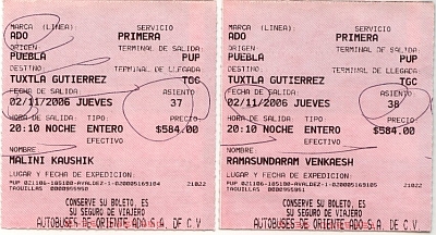
From : Puebla
To : Tuxtla Gutierrez
Bus : ADO
Distance : 597 miles/961 kms
Time : 10:05
Price : Mex$ 584
From : Puebla |
|


Entering the narrows, Sumidero Canyon |
The Cañyón del Sumidero is a huge fissure in the earth a few kilometers east of Tuxtla Gutierrez, with the Rio Grijalva
flowing northward through it. In 1981 the Chicoasén dam was built at its northern end and the canyon became a narrow, 25km-long
reservoir.
From Embarcadero Cuhare, we took a 2 and half hour boat trip through the canyon between towering sheer rock walls that rise to a height of over 800 to 1000 meters. Along the way we saw an amazing variety of birds - herons, egrets, cormorant and even a few crocodiles. We stopped to look at some odd rock formations and interesting vegetation. One that was particularly notable is a cliff face covered in thick, hanging moss resembling a giant Christmas tree. Water was cascading down the 'branches' producing an interesting effect. At the northern end , the river opens out just behind the dam and the water here is over 250 mts deep. |

Looking down into Sumidero Canyon from a Mirador |
The canyon can be viewed from above from several miradores (lookout points) reached by road from Tuxtla. |
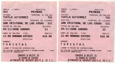
From : Tuxtla Gutierrez |
|

Splash of color - San Cristobal de las Casas |
San Cristobal de las Casas was the capital of Chiapas under the administration of Guatemala until the 19th century.
Founded in 1528, it was named after the Dominican bishop Fray Bartolome de las Casas who defended the Indians against
the excesses of the colonists. At an elevation of 2300 meters, it is cool and has a leisurely atmosphere.
It is a town of immense colonial charm and is a favorite haunt of travelers. The houses are mostly colorfully whitewashed one-story buildings with red-tiled roofs. There are several narrow cobbled streets with many intriguing nooks and corners to explore. With sections of some streets morphing into stairs, it is a walkers paradise. Several important churches dominate the town, most notable is the baroque Templo de Santo Domingo, whose intricate pink facade dates from the 17th century. Outside Santo Domingo, native women sell an amazing variety of brightly colored clothing and other woven items. Pottery, leather goods, woolen and cotton clothing, objects made out of amber are available for sale. The native Indians come to San Cristobal from the villages in the surrounding hills, each highland village has its own traditional dress. |

Market day - San Juan Chamula |
The village of San Juan Chamula, about 10km northwest of San Cristobal, is home to one of the largest subgroups of he native Tzotzil people.
They put up a strong resistance to the Spaniards in 1524 and also launched a famous rebellion in 1869 attacking San Cristobal.
Chamula is the center for some unique religious practices and Chamulans practice a peculiar brand of
Catholicism that combines Christian and pagan rituals and observances.
Photography is strictly prohibited in the village church or anywhere rituals are being performed. But we were able to visit the main church, "Templo de San Juan" and observe the proceedings. The Chamulans revere San Juan Bautista (St John the Baptist) above Christ, and his image occupies a more important place in the church. Family groups were seated on the floor that was carpeted with branches of pine needles. Candles and incense were being burnt all around, the light dazzlingly reflected in the many mirrors that surround the statues of saints dressed in holy garments. The head of the family reverentially chanted aloud and the whole scene makes a very powerful impression. Interestingly enough, Chamulans believe burping expels evil spirits and so Coca-Cola occupies and important place in Chamulan life. We observed families sitting sipping Coca-Cola in church, sight one is unlikely to see anywhere else in the world. We heard that the family with the Coca-Cola franchise here has a large house in the middle of the village in contrast to the more humble homes of other common people. |

Waterfalls at Misol Ha |
Enroute from San Cristobal to Palenque are two fascinating waterfalls, the first at Agua Azul and the next at Misol Ha.
The terrain is mountainous and windy road passes through some dense lush jungle. While the scenery around was breathtaking, everyone in our van was anxious as it hurtled at top speed around sharp turns miraculously avoiding oncoming traffic. Our driver was a man possessed. Agua Azul (literally blue waters), is on Rio Tulija and comprises several dazzling white waterfalls that thunder into turquoise pools surrounded by jungle. There is a 1 km or so walking path up the riverside that takes you higher and away from the crowds below. Misol Ha is about 20km south of Palenque. Rio Misol Ha drops about 35m into a wide pool surrounded by lush tropical vegetation. A path behind the main falls leads into a cave with smaller trickles. Despite it being rather cold, several people were enjoying a swim in the aquamarine waters. |

Templo del Sol at Palenque |
The Mayan ruins at Palenque is one of the highlights of the trip to Mexico. Its jungle location inspires both awe
and wonder as one sees an incredible complex of pyramids, chambers, terraces, staircases, temples, palaces and other
structures.
Palenque was first occupied around 100 BC and rose to prominence under King Pakal who reigned from AD 615 to 683. Pakal is represented in hieroglyphics of sun and shield and he is also referred to in Spanish as Escudo Solar (Shield Sun). or Guacamaya Blanca (White Macaw). He lived to the age of 80. During his reign, many plazas and buildings including the superlative Templo de las Inscripciones were constructed in Palenque. It is a superb example of Classic Mayan architecture which was characterized by mansard roofs and very fine stucco bas-reliefs. The pyramid, with a temple on the top dominates the whole site. Hieroglyphic inscriptions on three limestone panels inside, with the date AD 692, gives the temple its name. It recounts the history of Palenque and the temple. Archeologists discovered a sealed stone passageway that led to the burial chamber of Pakal 25 meters down at the center of the pyramid. The imposing funeral crypt is decorated with bas relief where the sarcophagus of Lord Sun Shield (Pakal) is located. The skeleton of the deified king was found wearing a mosaic jade death mask. |

The Acropolis, Bonampak |
The dramatic jungle setting of the ancient Mayan cities of Bonampak and Yaxchilán make them one of the most interesting places
to visit in all of Mexico. Till recently both these sites were quite inaccessible, but with the completion in 2000 of Carretera Fronteriza,
a paved road that runs parallel to the Mexico-Guatemala border all the way round from Palenque to the Lagos de
Montebello, it has become
easier to reach these sites.
So dense and overgrown was the jungle here that Bonampak was hidden from the outside world until it was discovered in 1946. The main ruins at this site stand around the rectangular Gran Plaza. The major surviving monuments were built under Chaan Muan II, who took the throne in AD 776. He was the nephew of the Yaxchilan ruler Escudo Jaguar II and was married to Yaxchilan royalty. A 6m high Stele in the Gran Plaza represents Chaan Muan at the height of his reign. Templo de las Pinturas contains masterly frescoes painted for Chaan Muan and are what give Bonampak its fame. Bonampak means 'Painted Walls' in Yucatecan Mayan. Diagrams outside the temple help interpret the badly weathered murals, which would otherwise be hard to understand. |

Building with a grand roof comb, Yaxchilan |
Yaxchilan is located in an equally marvelous jungle setting above a loop of the Usumcinta river. This natural boundary forms the national
border between Mexico and Guatemala and makes for one of the more interesting border crossings anywhere in the world.
To get the ruins, we took a half hour river boat running downstream from Frontera Corozal.
Over a four hundred year period, Yaxchilán developed into a powerful urban center in the midst of dense jungle. There are over 120 structures in the central area distributed over three great complexes, the Great Plaza, located in the lower part parallel to the river, the Grand Acropolis and the Small Acropolis, all of which are skillfully adapted to the contours of the low limestone hills by means of terraces and platforms. Stairways, ramps and distribution terraces connect these three complexes. Yaxchilán is famed for its ornamented building facades and roof combs, and stone lintels carved with conquest and ceremonial scenes. Conquests and alliances made Yaxchilan one of the most important pre-Hispanic cities in the Usumacinta region. It peaked in power and splendor between AD 681 and 800 under the rules Escudo Jaguar I (Shield Jaguar), Pajaro Jaguar IV (Bird Jaguar IV) and Escudo Jaguar II. |