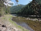
 Northwest Passage Scenic BywayThe reference to the Northwest Passage is from 1803, when Thomas Jefferson commissioned Lewis and Clark to find the Northwest Passage - a link between the Missouri River and the Columbia River through the unexplored Rocky Mountains. Of course, we now know that such a route does not exist, Continental Divide and all that. | 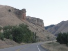 Salmon River Scenic BywaySalmon River Scenic Byway begins on the Montana border at the Lost Trail Pass (elevation 6995 ft.) and follows the Salmon River - also called the River of No Return - through the Salmon-Challis National Forest through the historic city of Salmon. It continues southwest on US-93 eventually veering west till Stanley for a total distance of 160 miles. | 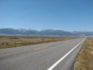 Sacajawea Historic BywayThe Sacajawea Historic Byway starts at Salmon, Idaho and continues southeast on Idaho Highway 28 through a very sparsely populated region - wide and flat - between two mountain ranges before bending left through Idaho Highway 33 for a short stretch till I-15. This historic byway is named after the Shoshone woman who was born here but was captured by the Arikara tribe and forced to live among them in North Dakota. She later became a trusted member of the Lewis and Clark expedition (the only woman, the only teenager and already a mother). |  Lewis and Clark Backcountry Scenic BywayThe Lewis and Clark Backcountry Byway is the one that is the centrepiece of this trip. It is located 20 miles southeast of Salmon off of Idaho 28, forming a 40 mile loop beginning and ending at the Tendoy store. The roadway is unpaved but can be traversed in a regular car with reasonable wheel clearance. The Agency Creek Road section is steep. | |||
 EBR-1The Experimental Breeder Reactor-1 is a national historical landmark located at Idaho National Laboratory off US-20/26 near Arco, Idaho. A breeder reactor is one that produces more fuel than it uses. This is considered the first nuclear reactor in the world that was used for generating electricity. | 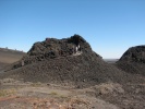 Peaks to Craters Scenic BywayThe Peaks to Craters Scenic Byway covers a diverse stretch of road with wetlands, high mountain desert vistas, lava flows and views of several high peaks including the highest, Mt. Borah. It starts at the Junction of Idaho 75 and US 20 and through southeast to Arco before turning left on US-93 to its junction with Idaho 75. It passes through the Craters of the Moon National Monument. | 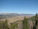 Sawtooth Scenic BywayThe Sawtooth Scenic Byway traverses the section of Idaho 75 from its junction with US 93 in the south to the town of Stanley in the north. It passes through the resort towns of Hailey, Ketchum and Sun Valley and then climbs steeply to Galena Pass offering magnificent views of the Sawtooth range and the wide valley below. | ||||