Double Crossing
A little bit of history…
The 1783 Treaty of Paris, concluded between the United States and Great Britain at the end of the American Revolutionary War, stated that the boundary of the United States extended from the center of the Lake of the Woods (now partly in Minnesota, partly in Manitoba, and partly in Ontario) directly westward until it reached the Mississippi River. But in fact that Mississippi does not extend that far northward; the line going west from the Lake of the Woods never intersects the river.
The parties did not suspect that the source of the Mississippi River, Lake Itasca (then unknown to European explorers), was south of that point. The entire Mississippi was too far south to be intersected by a line running west from the Lake of the Woods. The parties had used the Mitchell Map during the treaty negotiations; that map showed the Mississippi extending far to the north. In the Anglo-American Convention of 1818, the error was corrected by having the boundary continue due south from the northwest point of the lake to the 49th parallel and then westward along it.
When a survey team finally located the northwestern-most point of the lake and surveyed this north–south line, it was found to intersect other bays of the lake and therefore to form the boundary of a section of U.S. territory to its east, now known as the Northwest Angle.
End of history. Back to the present.
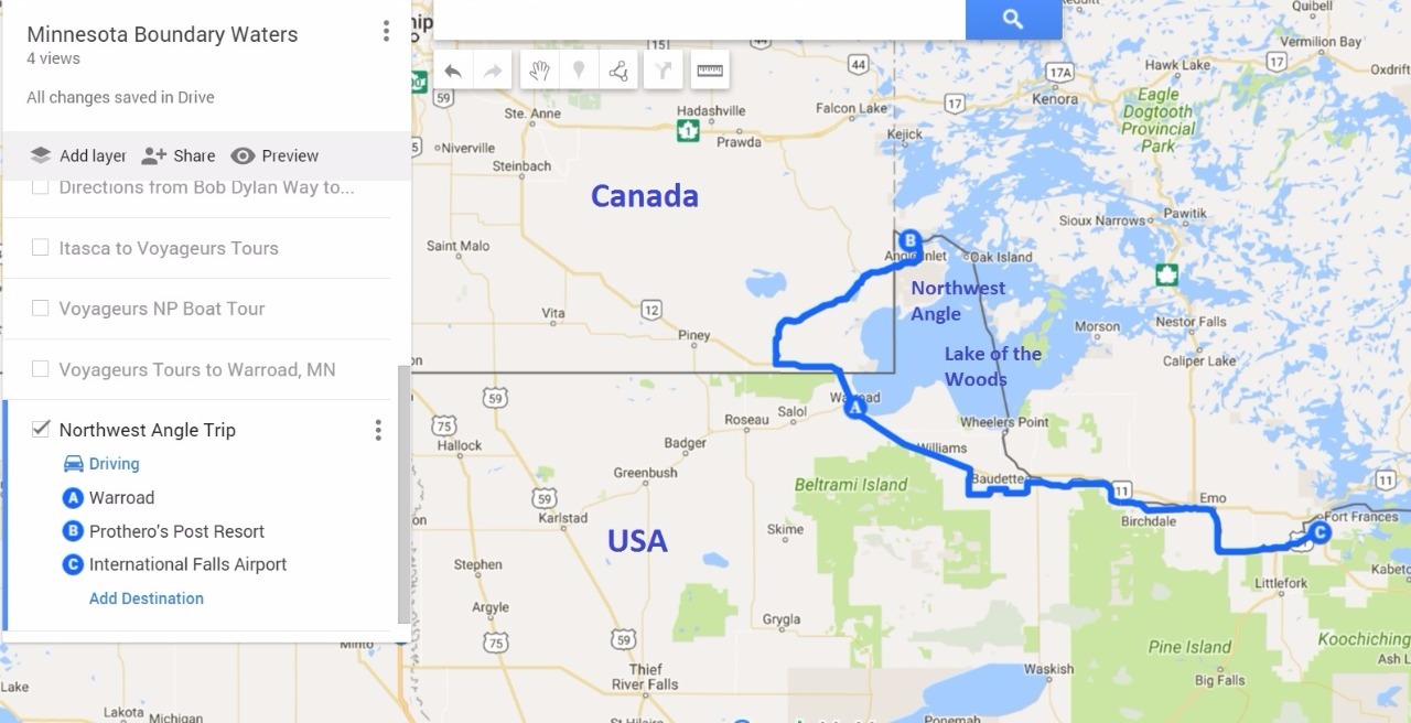
The consequence of the above events persist till today. Northwest Angle is a part of Minnesota (USA) and is cutoff from the rest of the country by a small stretch of Manitoba (Canada). The only direct way for domestic travel between NW Angle and the rest of Minnesota is by air or by ice road in the winter. No auto ferries operate on the lake and hence it is not possible for vehicles to cross the lake in summer.
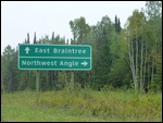
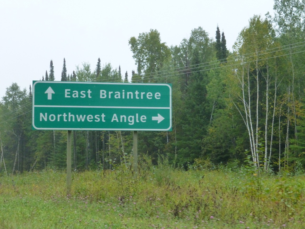
Of course, the other way to get to NW Angle is by driving through Canada. Here are the precise instructions: “To reach the Angle by land, travelers take Minnesota State Highway 313 Northbound (Warroad, Minnesota to Sprague, Manitoba) across the border into Manitoba, Canada, connecting to Provincial Road 12 in Manitoba at the border, then to Provincial Road 308 Manitoba, to Provincial Road 525, then finally crossing back into the United States in the Northwest Angle south of rural Angle Inlet, Minnesota (Angle Inlet Township). The distance from Warroad or Roseau to the Angle proper is approximately 63 miles through Minnesota and Manitoba back to the Angle's U.S. border. It is approximately 10 miles from the actual border (intersection of Manitoba #525 and NWA Road Dawson) to the rural developments of the Northwest Angle.”
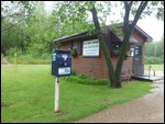
Tickled at the prospect of 4 international border crossings in one morning, we eagerly undertook the task. We carefully reviewed reports of visitors and learned of the registration procedure for entering and leaving NW Angle. Since there were no manned border posts at the NW Angle border, visitors had to register via videophone at a dedicated booth located in a street corner known as Jim’s Corner. This spot is actually 10 miles into US territory from the border. The phone has 2 buttons marked with the flags of the two countries. Press the US button when entering and the Canada button when leaving.
We departed at a quarter to nine from Warroad and reached the Canadian border within minutes. We informed the woman at the Canadian border post that we were headed for NW Angle. She gave us a printed sheet with precise instructions on the videophone procedure and the road directions (we needn’t have researched this extensively the previous night). Then she uttered a very sobering warning: “If you fail to follow these instructions and are unable to quote the reference number (that the official provides you on the phone) on demand, you will be fined thousands of dollars and your vehicle will be seized”.
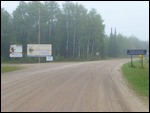
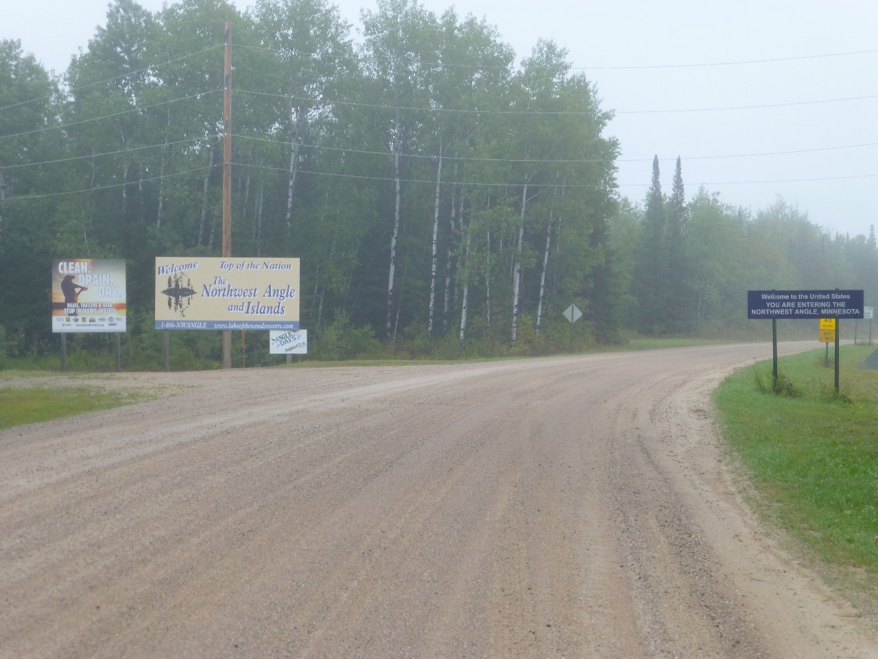
The road (Manitoba-12) goes further west a few miles before the turnoff at Sprague (Domo gas and Mom’s Diner - mentioned in the printout given to us at the Canadian post) to provincial road 308 Manitoba. A half hour’s lonely drive on this road brought us to the turnoff to Provincial Road 525. We were reassured to see a sign pointing to “Northwest Angle” and after turning into 525 another sign “US Border 10, Angle Inlet 26”. As expected, the pavement ended and the gravel road began slowing us down to 30 mph. A short while later we saw the signs “Welcome to the United States” and another that said “YOU ARE REQUIRED TO REPORT TO US CUSTOMS and BORDER CONTROL VIA THE VIDEOPHONE AT JIM’S CORNER (8 MILES AHEAD)”. And then another that said “ON YOUR RETURN TO CANADA YOU MUST REPORT TO CANADA BORDER SERVICES AT ONE OF THE 3 REPORTING STATIONS”.
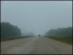
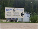
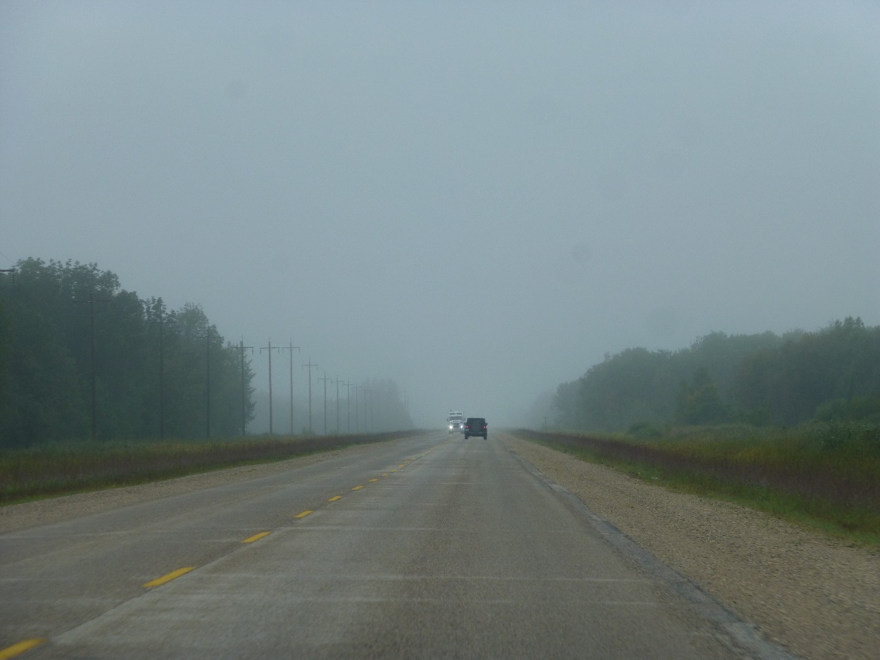
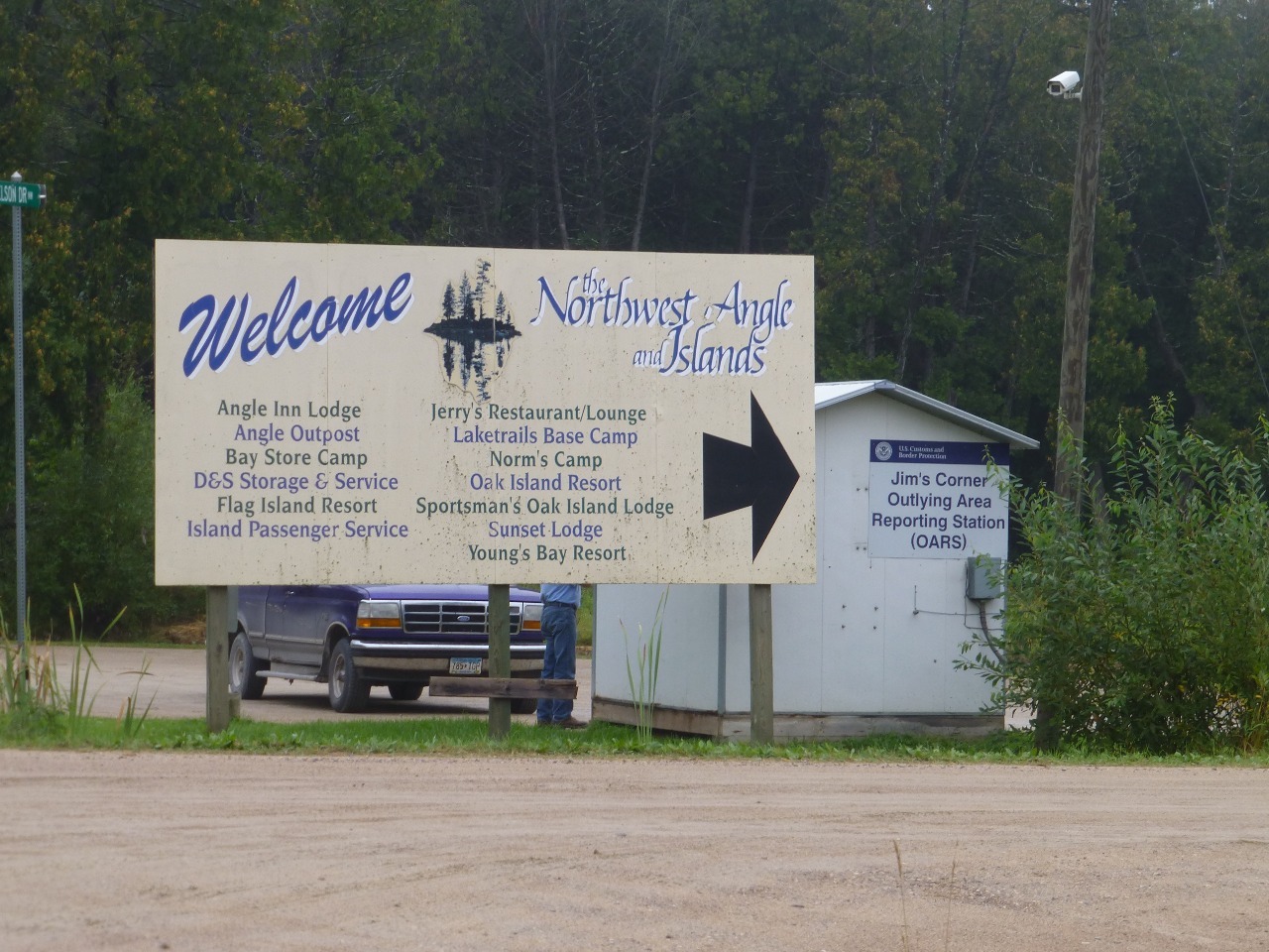
So, we continued through the dense fog on the dirt road before arriving at the crossroads. A huge sign welcomed us to the Northwest Angle and Islands, almost obscuring a small white shed. A large black arrow on the sign pointed to the part of the building that it itself did not obscure. There were a couple of cars car parked and one person on the phone mounted on the outside of the booth. We wondered what people did if it rained heavily. The answer came in the form of a person exiting the booth from the inside where there was another phone.
When our turn came, we pressed the button with the US flag and saw our own faces on the screen. We read out our passport details and our rental car license plate number and how long we planned to stay (< 30 mins). We were not given any reference number and were told that it will only be given by the Canada customs on our way out.
We drove the remaining few miles of dirt road to Angle Inlet and saw a few scattered buildings. A shed proclaiming itself to be “General Store” had a cylinder outside that said “Gas” and a sign that said “Lots of Groceries. Things. Tackle. Hardware”. A small shed with sign “US Post Office. Angle Inlet, MN, 56711. Most northerly P.O. in Contiguous U.S.” It was closed on account of the Labor Day holiday. We saw another vehicle trying to squeeze into the lot, so we reversed to pull out. Turned out that the person in the other vehicle just wanted to chat briefly. Been here since June. Great place. How long you here for? Just a half hour? Oh!
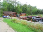
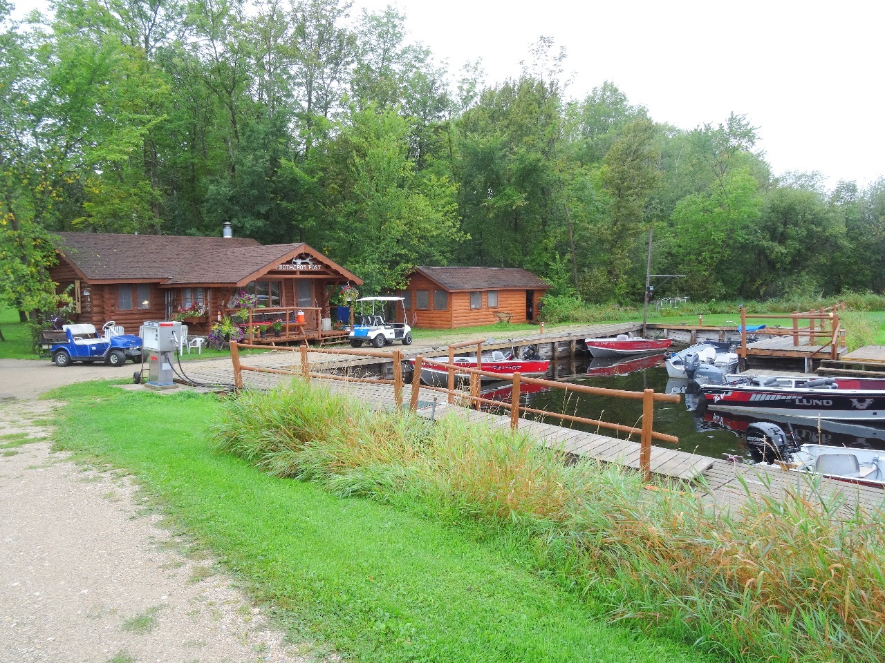
We managed to find Prothero’s Post Resort that was a bunch of pretty reddish orange colored buildings by the lakeshore. We hoped that they would have some hot coffee but the shop only sold souvenirs. There were a few people at the back watching TV and making boisterous noises. We did not find anything more interesting to do, so we took a few selfies and retraced back, pausing at a few residential streets. Spotted a few more buildings on our way out. A hangar. A church. We were looking for a school building but could not locate it.
There was a bigger queue at the video booth and it appeared that the Canadian office put you on hold for several minutes. We eventually got someone on the line and they took all the information and gave us a reference number. We wrote it down on a piece of paper and took a photo of it on our cell phones and stowed it away carefully remembering the warning we received at the main border.
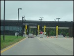
We had lunch at the diner on the Highway 12 intersection and crossed the main border back to the US shortly after. Another long chit chat with the US official about our passports and all the stamps in it. We wondered if we should let him know that Ben Franklin’s butler had confessed, but decided that it would only cause confusion and that it was better to leave things as they are. Then the long drive back to International Falls airport to catch our connector to Minnneapolis/St. Paul. The CRJ200 was only half full and most were seated in the front of the plane. The pilot requested volunteers to move to the back to ensure that the aircraft was properly balanced. V got up and sat in the back. First time that’s happened.
Photo Album


Comments