What is “remote”?
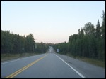
Remoteness attracts travelers and if it succeeds it ends up losing that very quality that drew in the masses (individually not severally). How does one gauge remoteness? Is it the distance from the nearest populated (roughly speaking) settlement which is how Easter Island claims its spot at the top of the heap (being 2000 odd miles from the nearest town/village). However, the island claims it based on the vast body of water that surrounds it. The stretch of US-50 in Nevada is proud of its “loneliness”, a slight alteration of the same idea. Based on the unscientific basis of the effort it takes for one to get there, the Boundary Waters region of Minnesota can proudly stake its claim for the top of remoteness stakes.It only takes an hour’s flying time to get from Minneapolis, the largest city in Minnesota to International Falls but it brings about a dramatic change in landscape. Minnesota is known as the Land of 10000 Lakes and one can see a lot of them from the air.
We are drawn to the region this fall excited at the prospect of adding two more National Parks to our collection which contain over 40 of these (out of a total of 59 - and considering only National Parks (NP), not National Monuments (NM), National Historical Parks (NHP), National Forest, National Seashore etc.). Technically speaking, only one of the two - Voyageurs National Park - is in the state of Minnesota. The other one, Isle Royale National Park, a remote island in Lake Superior, is in the state of Michigan. In terms of proximity, it is closer to the eastern shore of Minnesota or the Canadian province of Ontario. Such are the vagaries of man made geographical divisions in the face of unyielding nature - which would be yet another theme that we would explore on this visit.
Our quirky itinerary
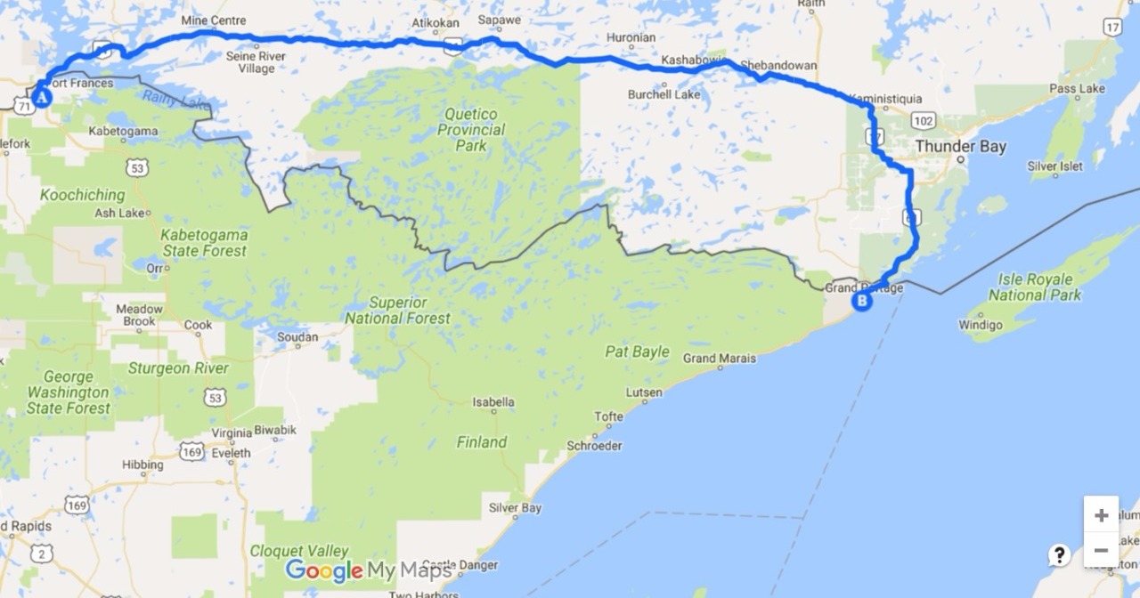
Voyageurs National Park is accessed from a ferry landing just 11 miles east of International Falls which is the reason we chose to fly to that airport. After booking our return trip from San Francisco to International Falls, we learned that we could only make a booking for the Voyageurs park ferry on the Sunday after our Thursday afternoon arrival. Given the need to accommodate both national parks in a 5 day itinerary, we had to proceed directly to Grand Portage, Minnesota which is the closest point to access Isle Royale via private boat for which we could get reservations on the morning after our arrival in the state. However, this meant that we had to cover the 250 mile distance from International Falls to Grand Portage on Thursday evening so that we could catch the 8:30 am private ferry to Isle Royale.
Interestingly, there are 2 ways to get from International Falls to Grand Portage. One of the routes is entirely in the state of Minnesota (which is entirely in the US of A!) and would take 4:30 hours to complete the journey. A suitably fattened crow could fly in a straight line in under 2 hours, but the rugged landscape of the boundary waters required a winding non-linear route. The other alternative was more interesting to us given our penchant for land border crossings. And we are talking international here. The Canada border is just a few miles north of International Falls. And the Trans Canada highway (Highway 11) is an approximately straight line east all the way to town of Thunder Bay on the shores of Lake Superior and a short stretch of 45 miles south would get us Grand Portage, back in the US of A. We’ve crossed many land borders in all manner of transport - buses, cars, trains, boats etc. but never piloted by ourselves. And they don’t come much easier than these borders between two friendly countries. Given that the distance/time equation was more or less equal, we opted to add this element of adventure (albeit stress-free) to the long evening drive.
Tiny International Falls Airport
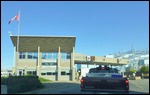
The airport at International Falls is as tiny as they come. The entire building is but a little shed that contains arrivals, departures, baggage claim, security and rental car counter. Even the arrival of a 20 seater plane could result in the rental car queue (of 2 parties) jostling with those waiting at baggage claim. The small triangular parking lot accommodates private vehicles and rental vehicles with no earmarking. Just look by the fence for the black Malibu!
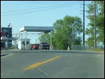
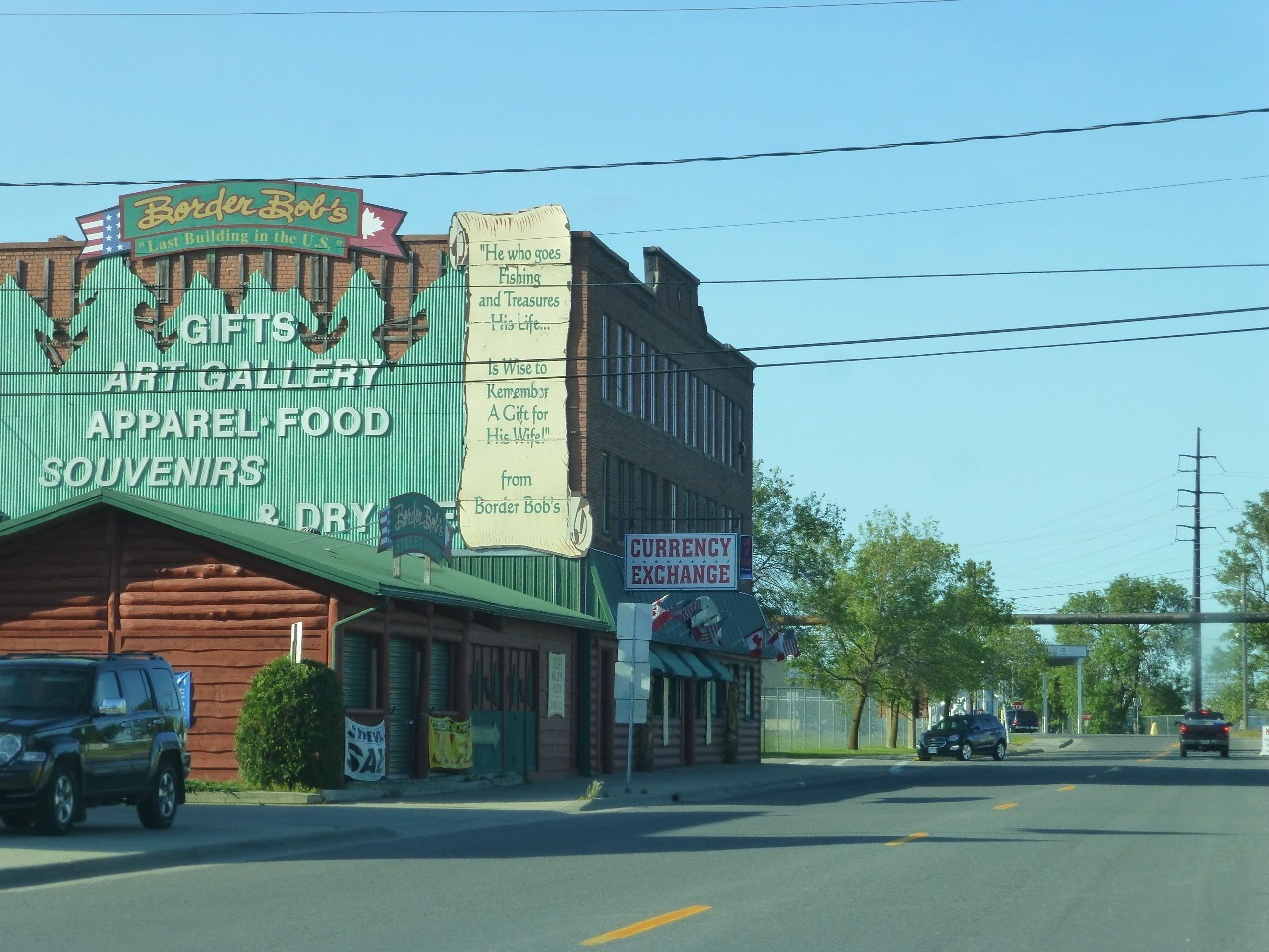
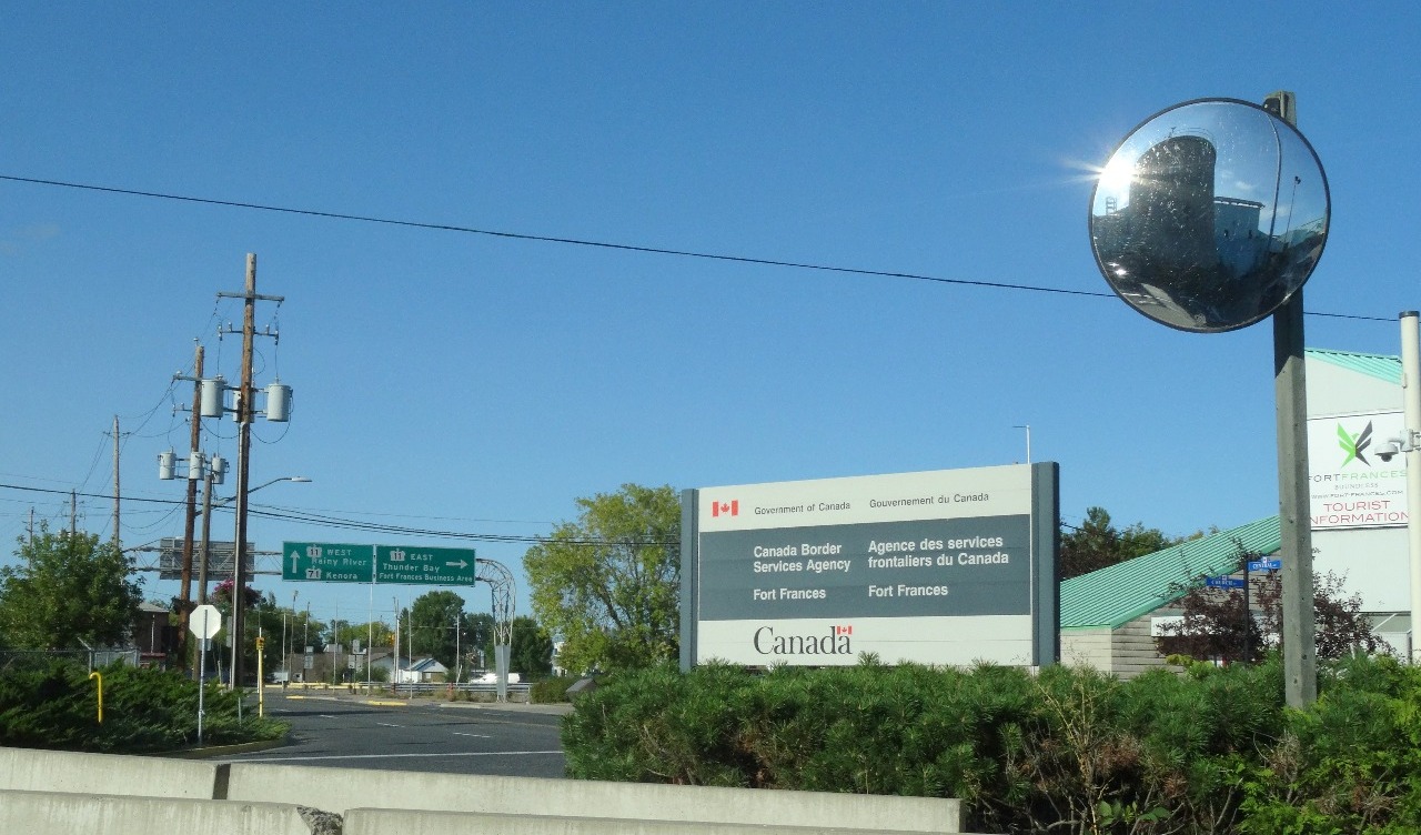
The Canada border is about 3 miles from the airport with a sign pointing left towards 2nd avenue in the town. We stayed in the car throughout as we passed through the customs of both countries. We told the Canadian officer that we intended to drive back into the US after driving east to Thunder Bay. There was just the small matter of crossing the international bridge across the Rainy River which defines the border west of International Falls all the way up to Wheeler’s Point where the river joins the Lake of the Woods. But we are getting ahead of ourselves. We don’t want to give the ending away so easily. So please read on, the butler did not do it, we can assure you. Ben Franklin had something to do with it. Ok, that’s enough, we’ll get to that later.
Trans Canada Highway
"It’s 106 miles to Chicago, we’ve got a full tank of gas, half a pack of cigarettes, it’s dark and we’re wearing sunglasses. Hit it!”
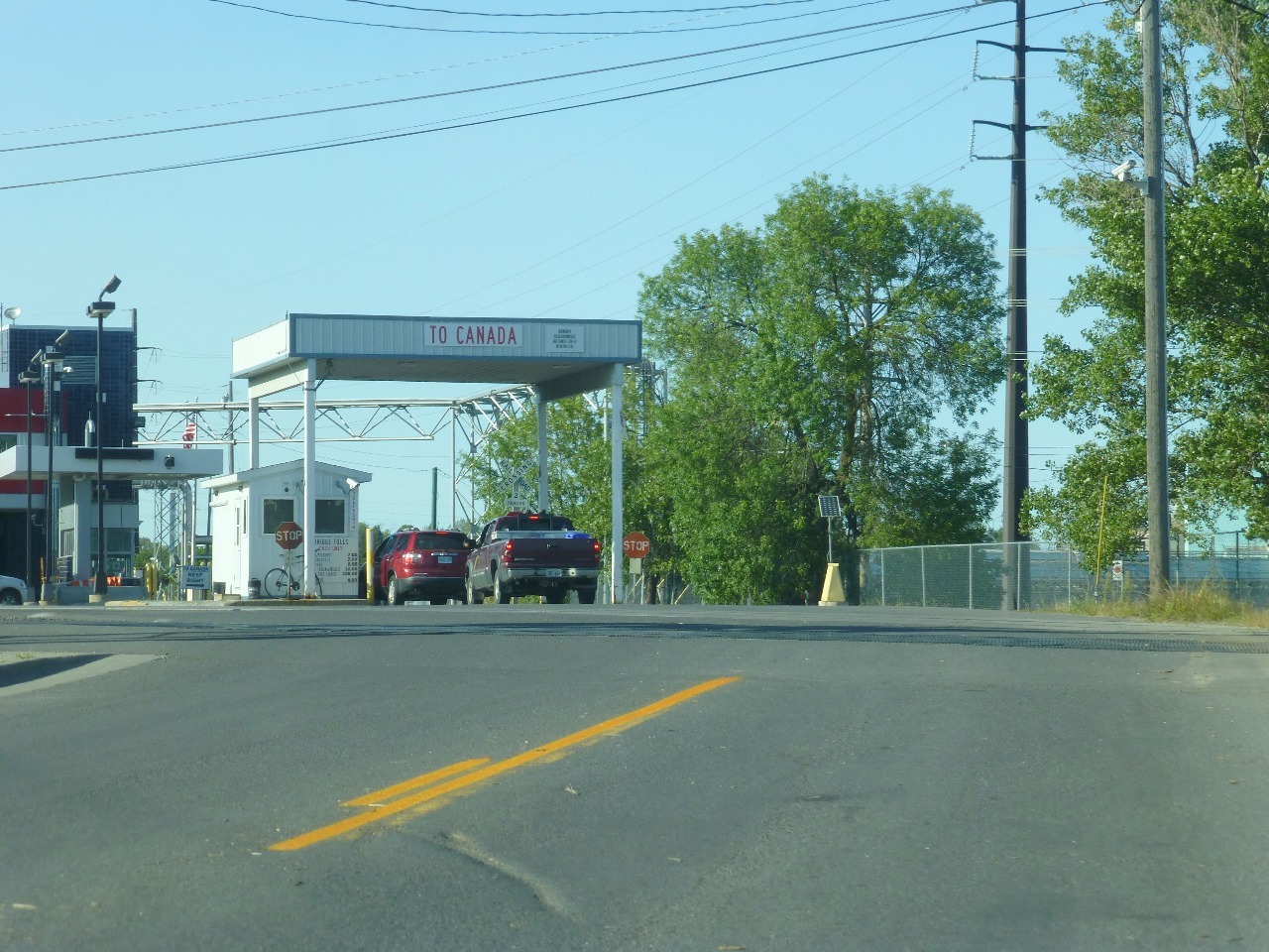
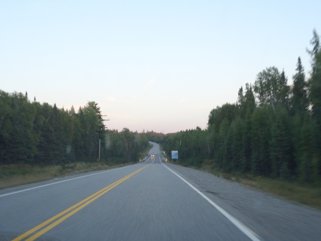
Well, substitute 250 for 106, Grand Portage for Chicago, a pack of McVitte’s biscuits for the cigarettes, a couple of hours to dark etc. Once past the border town of Fort Frances, Ontario (V’s first visit to the province!) and some slow downs for construction, we lost civilization and drove 200 miles of stupefyingly unchanging greenery. We had experienced the so-called Loneliest Road in America in Nevada, but that highway does pass through the occasional town every 70 miles or so with some options for relief. Not so on this stretch of Highway 11. There were signs for Mine Centre, Seine River Village, Atikokan etc. but we soon realized that these would not have the usual options for food, gas and rest areas. Even these destinations (and other minor ones like resorts) were not on the highway but on dirt roads off highway with distances of 12/20/30 km etc. We also realized that our rental car had no kilometer markings on the speedometer and other gauges. All the cars we had seen in the US have both. So now we had to translate all distances (as well as the varying speed limits). We have become truly Americanized.
As the hours passed, and the fuel gauge dipped and the biscuits disappeared we grew concerned and wondered if we could make it all the way till Thunder Bay with the fuel in the car and will we get there in time to get a decent bite to eat. There was no cell phone connection throughout. We did make the 8 km detour on paved road to the small town of Atikokan for refreshments and topped off the fuel tank before heading further east. We estimated that we would arrive in Thunder Bay by 9pm. Uh oh, there is the sign that says “Entering Eastern Time Zone”. Make that 10pm. What sort of a town is Thunder Bay? What would be open at 10pm on a Thursday night? We discovered that we needn’t have worried. Thunder Bay was a large town with several establishments that served food late. We got some pizza and stocked up on emergency supplies for the rest of the trip.
Leaving Canada already, eh?
The official at the Canada customs was surprised at our brief visit to their spacious country, bewildered no doubt by our declination of its enormous resources of sustenance and enchantment on offer. In appreciatively grateful sincerity of regret, we cited our momentous appointment with a remote US national park the next morning as our reason for the short “stay” (if indeed it can be termed that). We kept our counsel on how these borders were a result of accidents of history that we (so to speak) should be treating lightly. Would a moose that freely straddles the watery border care whose hospitality it was enjoying during its forays looking for a tasty snack of balsam fir? But, but, we are getting ahead of ourselves again. We shall discourse at length on moose diet and how it is yet another specimen of animal whose singular and plural usage is identical when we talk about our attempts to spot the elusive animal at the park tomorrow.
Back in the U.S (yes, saar!)
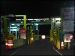
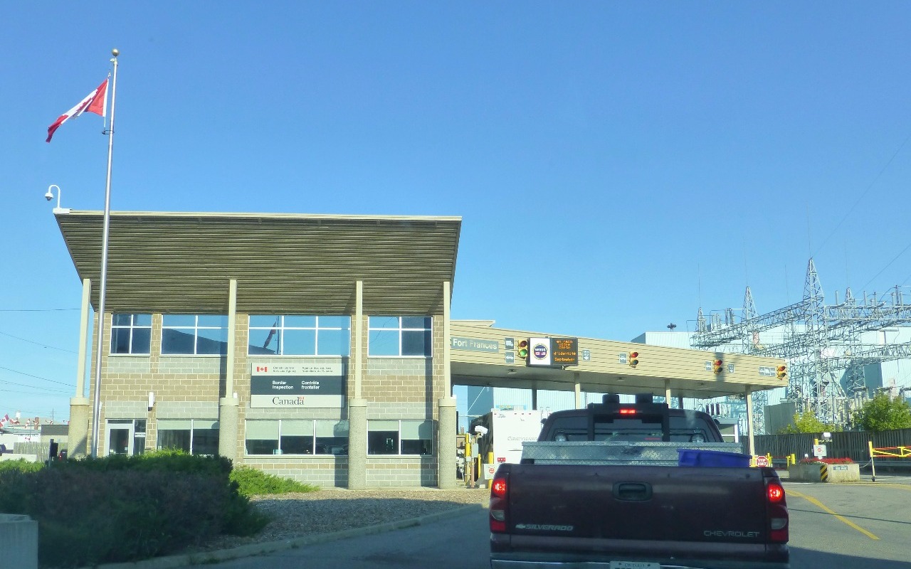
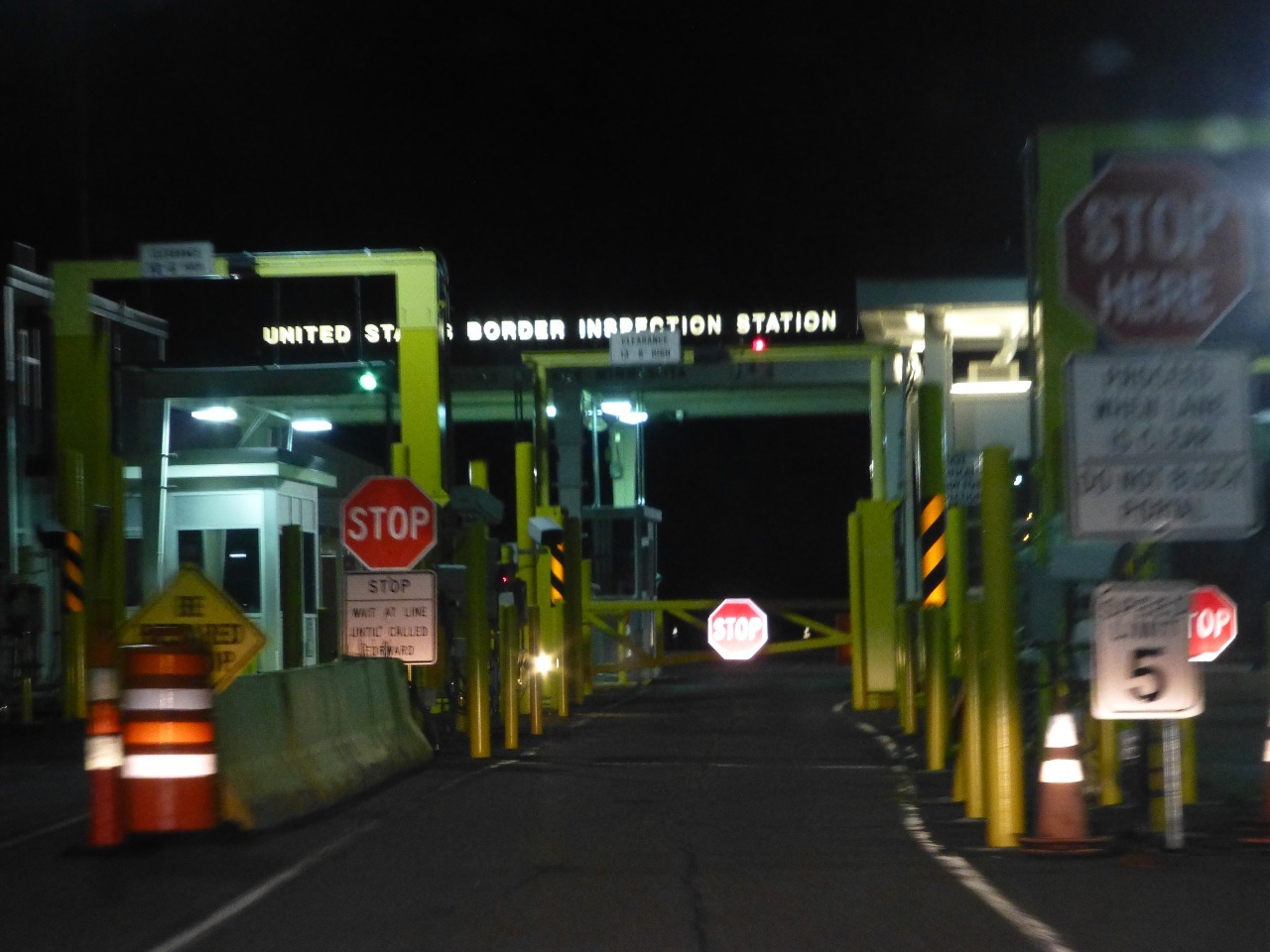
The official at the US Border was puzzled by our explanation of how we ended up at this location after having landed in International Falls earlier that afternoon. So we told him a short version of the story that we told you above. And just like you were confused and unconvinced, he too was unimpressed. And in his hands were our two fat passports with visas and stamps of countries he was only vaguely familiar with. He asked to pop the trunk and we could not figure out how to do so with the remote (this particular model required the button to be held down 2 seconds we learned later), so he took it and popped it open. We were obviously not supposed to get out of the car, so we just stayed in. He made good natured small talk for a short minute or so and then waved us on making sure he returned the remote.
The State of Minnesota welcomed us back in the dark via its road sign and we were soon comfortably lodged at the Grand Portage Lodge and Casino. We got casino vouchers that were valid till midnight, just a half hour away. After the long evening we just had, we were not in any mood for gambling and so we called it a night.
The US-Canada border
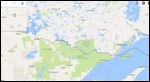
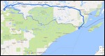
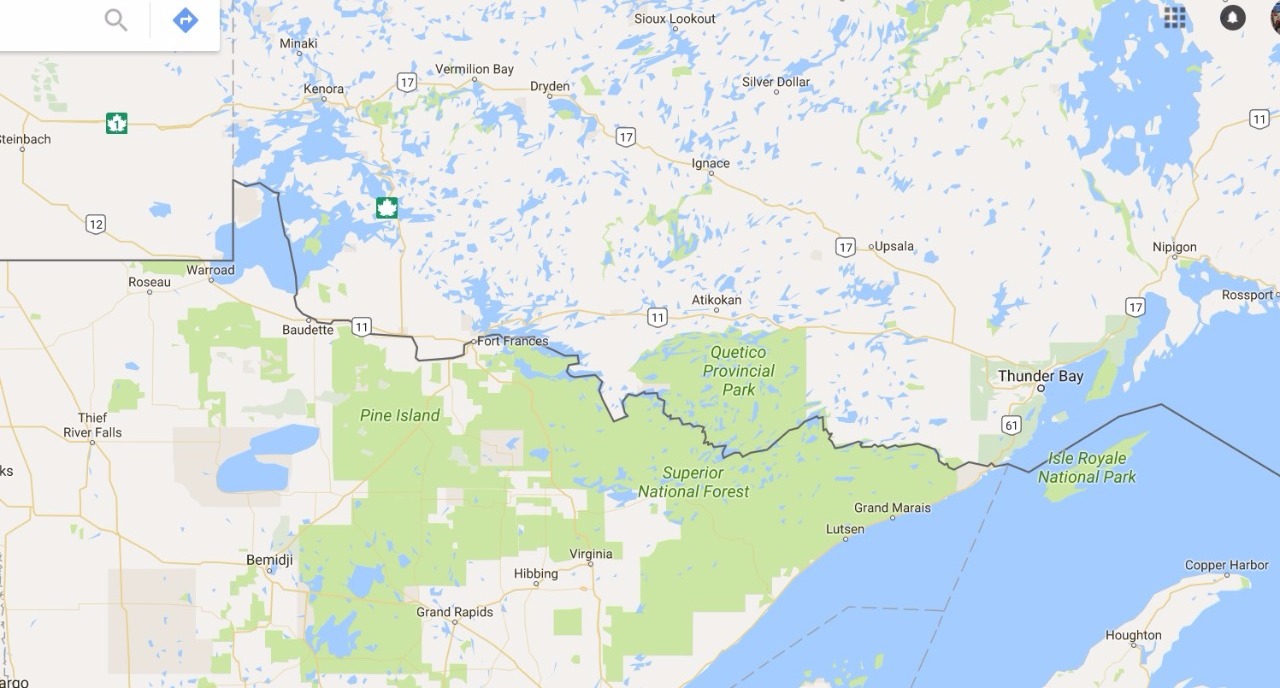
We invite you to browse Google Maps and examine this border in some detail for a few minutes. This would help you make up your mind on whether you want to continue reading this travel essay or not. These few minutes could save you hours of navigating through dense prose. Some might prefer navigating the boundary waters on birchbark canoes, but we are getting ahead of ourselves again. The border is dominated by the straight line - 49th parallel - that runs unbroken for about 1200+ miles all the way from near Vancouver to the middle of North America. West of Vancouver, it curves downward to hold up Vancouver Island and divide evenly the islands on the Strait of Georgia between the two countries. The straight line is impressive in its length and it is not all flat land like Kansas or Texas. The line crosses the mighty Rocky Mountains without so much as a blip in its quest to retain its shape.
But something bizarre happens in the middle. For apparently no reason, the line makes a 90 degree left turn and then a sharp downward right and then precipitously downward in the Lake of the Woods before entering Rainy River. Henceforth, manmade parallels are forgotten and nature rules. The border follows the Rainy River all the way to Fort Frances/International Falls before encountering the wide expanse of Rainy Lake. The border continues through the lake before it squeezes through Kettle Falls (and Dam) executing a tortuous maneuver which turns the two countries upside down with Canada coming south of the border for a while before sanity is restored. But what brought about the temporary insanity? Was the border drawn by a quirky kid who was connecting the dots of the outline of a howling wolf? As you can see, I am trying to distract you with these side games just to make you forget about the butler. Patience.
Further east, it seems to seek a waterway to the Great Lakes, navigating the maze of the many water bodies. At times it is blocked by tracts of land (e.g. Prairie Portage) before continuing on through a series of lakes (Gunflint Lake, North Lake, Rove Lake, Mountain Lake, Moose Lake, Fowl Lakes) before entering the Pigeon River which would take it all the way to Lake Superior. The last few miles of Pigeon river is a series of falls and rapids that are not navigable thereby requiring a “portage” of about 8.5 miles (clearly marked as a green pathway) for the voyageurs who were engaged in the fur trade requiring them to transport goods from Western Canada all the way east to Montreal and onward to Europe.
If the above exercise bored you to pieces, you are invited to browse the photo album and enjoy our selfies.
Photo Album
Comments