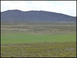
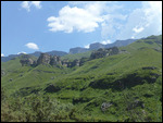
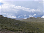
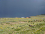
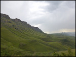
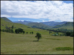
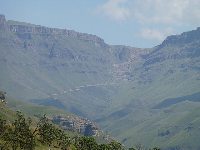
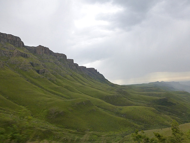
From the Wild Coast our journey turned inwards, towards the famed Drakensberg mountains. At the southern end of the Great Rift Valley, Drakensberg is a 200 km arc of jagged mountain peaks that runs roughly north-south through Kwazulu-Natal province forming the border with Lesotho. The name means Dragon Mountain in Afrikaans, but the Zulu name uKhahlamba, Barrier of Spears, is even more evocative. With sheer sandstone and basalt cliffs towering over a high plateau, it offers some of the country's most awe-inspiring landscapes.
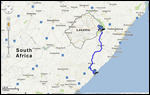
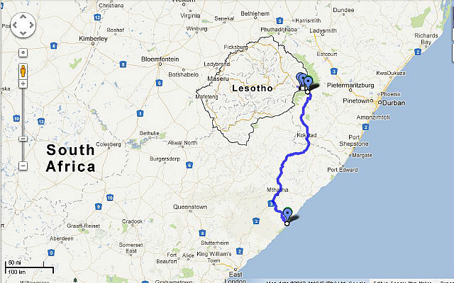
There is no single road linking all the areas of interest, so one needs to pick a region to explore. We decided to focus on the Southern Drakensberg area, partly because it was accessible on the Baz Bus route (by shuttle connection), but more importantly because it has a large wilderness area and boasts one of the regions's highlights - the journey up to Lesotho over the rugged Sani Pass.
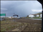
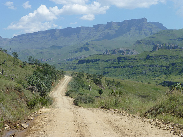
Since there is no public transport serving the area, we had made prior arrangements with our lodge to send a pick-up to the Baz Bus transfer point at Kokstad. After a two hour drive through total darkness that took us past the small towns of Himeville and Underberg, we arrived at Sani Pass Lodge, our base for the next few days. The lodge is located at the foot of the Drakensberg range and specializes in arranging hikes, multi-day horseback trips and trips to Lesotho.
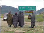
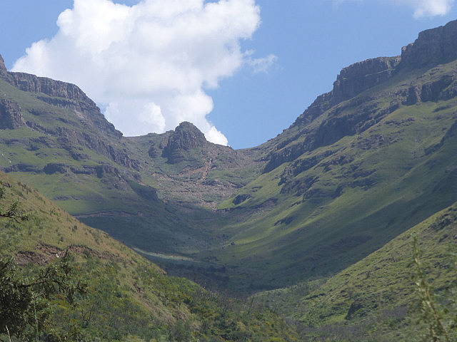
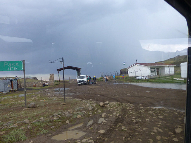
Named after the San people who once lived in the area, the Sani Pass was used by migrating animals for centuries before it evolved as a trade route for local settlers. Until the 1950's, it was a trail for pack animals bringing wool from the isolated town of Mokhotlong in Eastern Lesotho and returning laden with other goods. At an elevation of over 2865m, it is the highest pass in the country and today the only road link between the South African province of Kwazulu-Natal and the landlocked Lesotho.
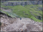
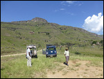
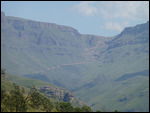
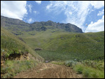
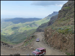
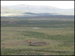
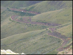
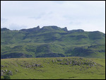
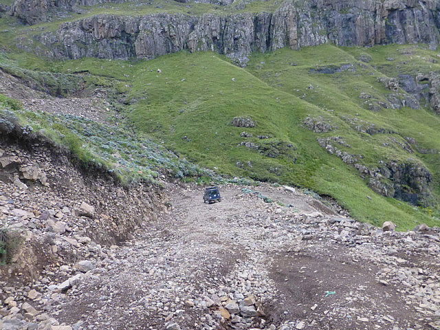
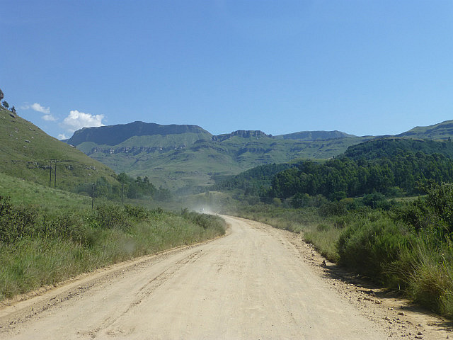
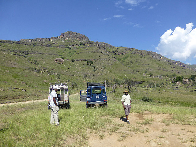
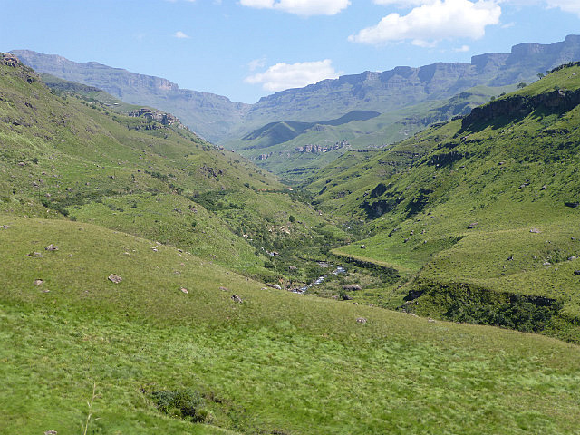
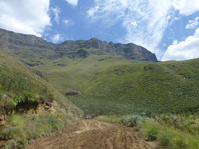
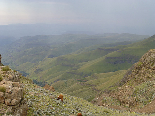
The road to the top of the pass is best traversed in a 4WD specially fitted with low range gears that can handle the rough terrain. Accompanied by a guide-cum-driver, we left next morning with a few fellow travellers in two Land Rovers, the most trusted vehicle in these parts. The route passes through the uKhahlamba-Drakensberg Park, a World Heritage Site that boasts the world’s greatest collection of San rock art created by more than 4,000 years ago. At our first stop, we saw what remains of the trading post from the 1800s and learned about the time when the Sothos (the people of Lesotho) used to bring down wool to trade with the white settlers. The road then snakes alongside a canyon beneath towering cliffs and past a few tumbling waterfalls.
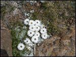
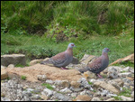
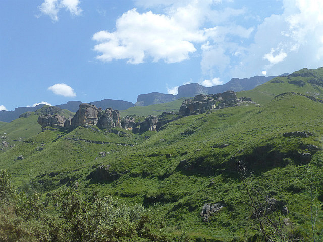
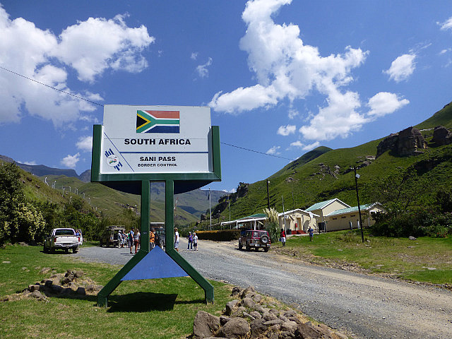
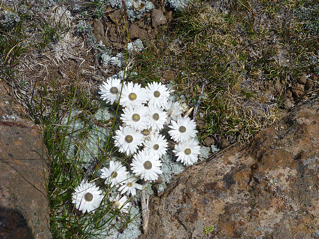
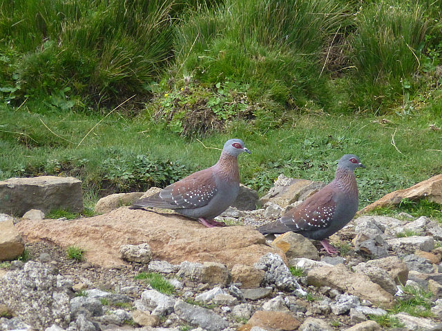
On the way we learned about the colorful plants and unique birdlife found at these mountains. We learned to identify the two common species of Protea that grow in these high elevations - Protea Roupelliae and Protea Caffra. A couple of Ground Woodpeckers made a brief appearance on some boulders and we could see Jackal Buzzards overhead. We soon arrived at the South African border post that is located at the base of the escarpment and our passports were duly stamped for exit.
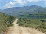
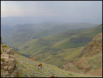
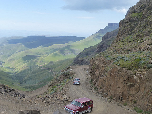
Beyond this point the state of the road worsens and turns into a jumble of stones and boulders interspersed with loose scree making for tricky driving even on low gear. It climbs sharply over a series of tight switchbacks, many of which have been given interesting nicknames. The Reverse Corner is where the turn is so sharp that vehicles are forced to back up to the very edge of the road before they can complete the turn. The 'Oh My God' corner reflects the typical reaction of the occupants of a vehicle when it gets here. One of the final turns is the Icy Corner - here water flowing water under a jagged outcrop turns into a frozen cascade between May and September when no sunshine falls on it. Altitude gain is rapid and the road climbs 1330 meters in just 8 kilometers!
Video : South Africa to Lesotho over Sani Pass (Reverse Corner)
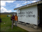
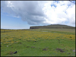
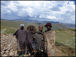
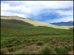
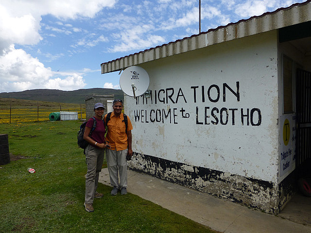
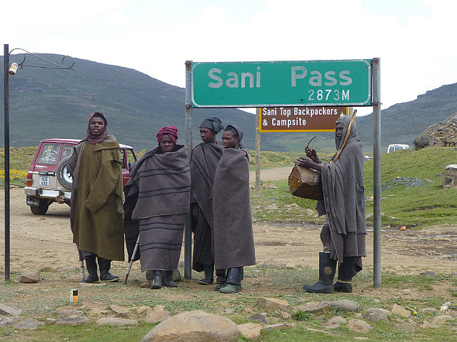
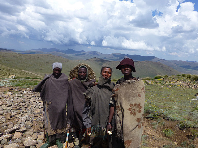
After a few knuckle-clenching minutes, the vehicles crested the pass. Right there, just over the ridge, is the Lesotho border post. A small unpretentious building with corrugated metal roof, it is set against a backdrop of rolling green hills carpeted with golden wildflowers and grazing sheep! A few shepherds in dark grey blankets wrapped around were standing under the sign marking the top of the pass. With our passports stamped again, we continued on the drive into Lesotho.
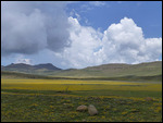
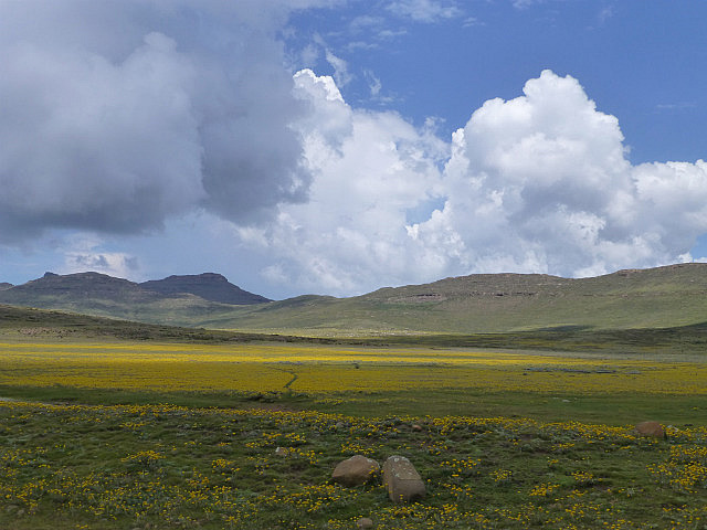
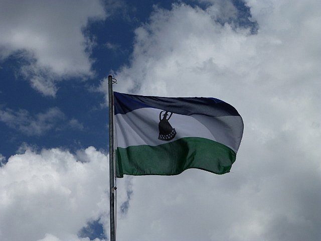
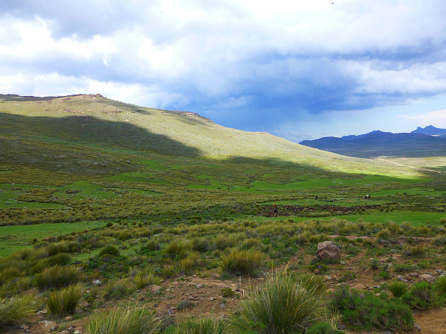
Lesotho is called Kingdom in the Sky for good reason. The stunningly beautiful, mountainous country is nestled island-like in the middle of South Africa. Close to 75% of the country is made up mostly of highlands where many of the villages can be reached only on horseback, by foot or light aircraft. In fact, it holds the distinction of having the highest lowest point of any country in the world!
Video : Inside Lesotho
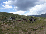
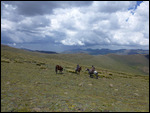
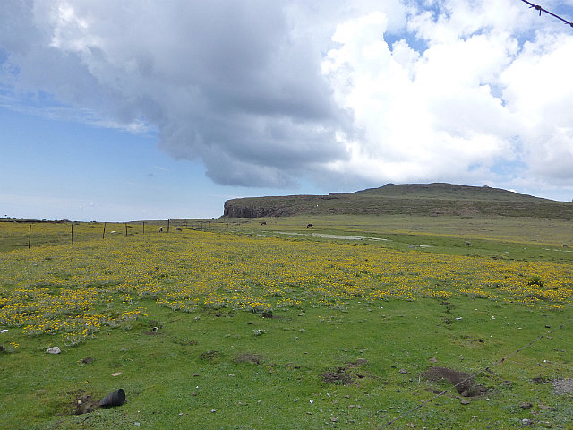
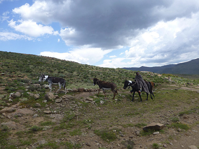
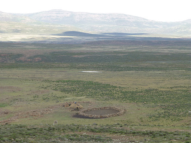
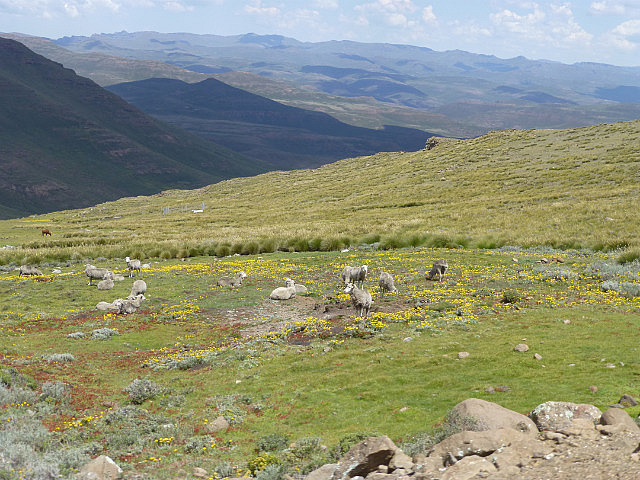
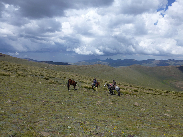
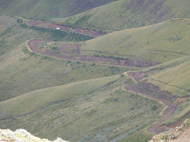
The road, only slightly better than at the pass, goes down and up the rolling hills for as long as the eye can see. We passed several shepherds' posts that were essentially small shelters with stones stacked for walls. Shepherd tended to their livestock both on foot and on horse back. We saw several flocks of Merino sheep and herds of Angora goats grazing on the hillsides.
But spectacular as the scenery may be, Lesotho ranks among the region's poorest countries. A consequence of the harsh environment of the highland plateau and limited agricultural space in the lowlands has meant that the country grows little food, manufactures next to nothing and is heavily dependent on South Africa for many of its basic needs. One of the few things that the country has continued to export successfully is wool, so young men in most families in the highlands are forced to become shepherds. Here they live isolated lives away from their families, tending their prized flocks. Diamonds and water are Lesotho's only significant natural resources. A multi-billion dollar project Lesotho Highlands Water Project has been capturing, storing and transferring water from the Orange River system and supplies water to South Africa's Free State and and greater Johannesburg area earning the country billions of dollars each year.
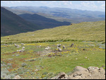
The drive inside Lesotho took us up Black Mountain Pass, the second highest road pass in Lesotho. We settled down by the hillside to enjoy a picnic lunch with stunning views in front of us. A short hike from there took us to the top of a nearby hill to view Thabana Ntlenyana, the highest point in southern Africa (3482m). Not properly acclimated to the altitude, even the short hike left us a little lightheaded and short of breath.
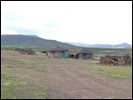
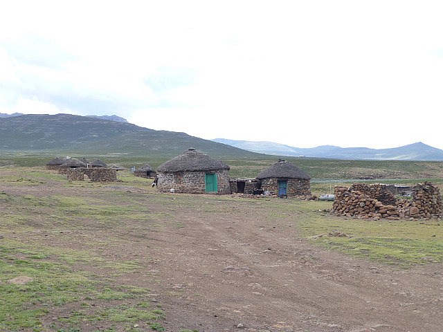
On the way back, we stopped at a small settlement consisting of a few traditional rondavels (huts) to sample the local brew and try some local bread. As we were leaving, a few shepherd boys had gathered outside vying for our attention. They formed a ragtag orchestra and tried to entertain us in return for some money. A few others simply asked for handouts. Clearly the living conditions here are very hard and these young men don't have many options in front of them. It is difficult to imagine how they live under these conditions all year round.
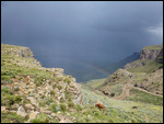
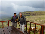
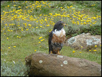
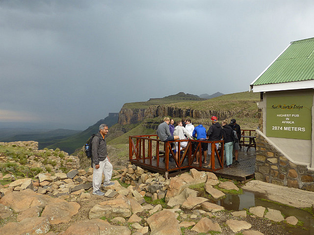
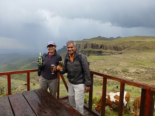
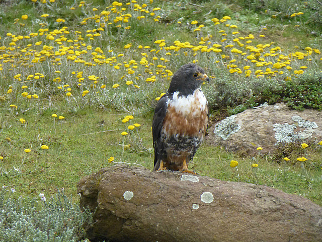
Returning to the top of the pass, we stopped at Sani Top Chalet, that proudly claims to the highest pub in Africa. From the outdoor deck of the the pub, one has a panoramic view of Sani Pass and the basalt summits that look like buttresses. A Jackal Buzzard perched on a rock by the deck and for once we could literally enjoy a birds-eye view just as a bird would.
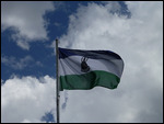
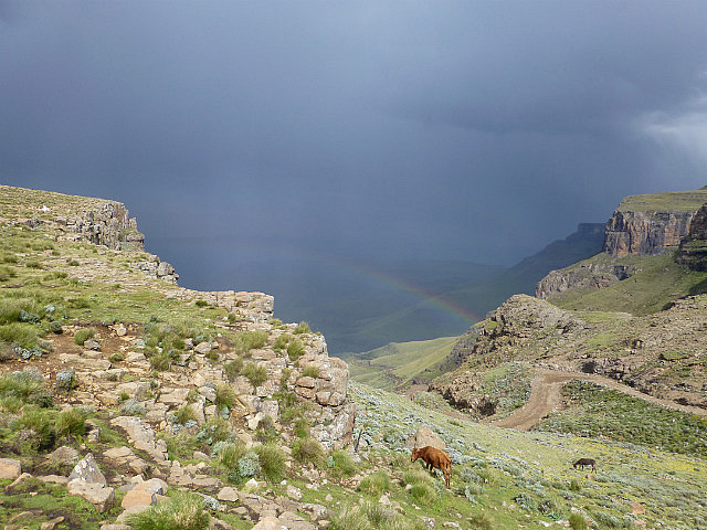
It had just started to drizzle when we got there and the appearance of a rainbow over the Pass added to the magic. Fellow travelers attempted to capture the spectacular lightning strikes on their cameras with little success. We celebrated with a bottle of Maluti, the only beer manufactured in Lesotho and took the opportunity to exchange some South African Rands for the local currency, the Loti (plural Maloti). Lesotho seems to have a penchant for rhyming names - its people are Basotho and the language is called Sotho!
Video : View of Sani Pass from Sani Top Chalet
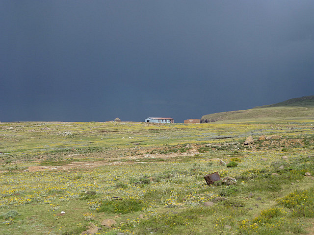
With the dark threatening clouds gathering on the horizon, the drivers wanted to descend the pass before heavy rains were upon us. Back at the border post to exit, we were in and out in minutes. On our way back we were able to enjoy the hairpin turns all over again as we descended the pass. Even before we passed the SA border control, it started to come down in buckets making driving on the rugged road not just a challenge but somewhat dangerous. A small waterfall that we had crossed on the way in, was now swollen into a rushing stream that had to be fjorded. With years of experience behind them, the drivers kept their cool and made it back to the lodge without incident.
Video : Crossing a Raging Stream on Sani Pass
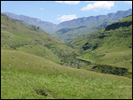
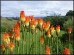
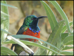
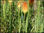
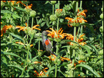
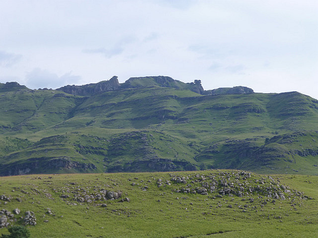
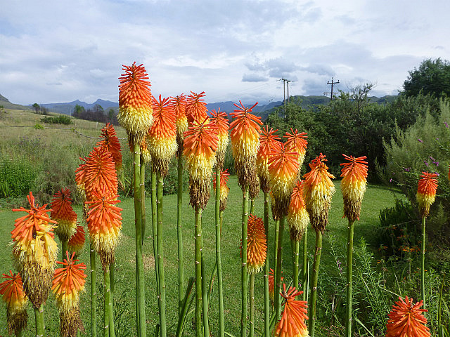
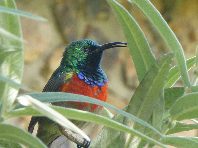
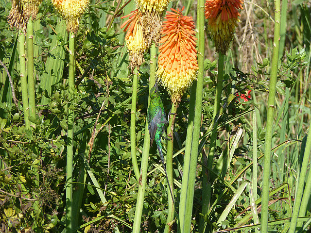
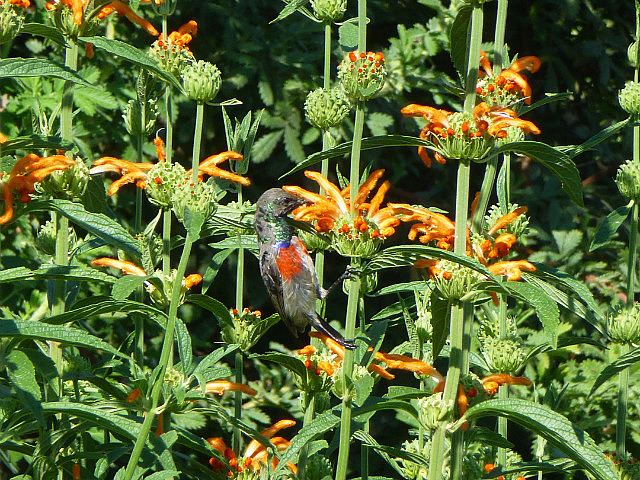
The Sani Mountain Lodge itself is a delightful place to stay and a haven for birdwatchers and nature lovers. The common lounge area opens out into a native garden with plants and flowers that attract birds and butterflies. You could just sit by the bay windows and watch a steady parade of beautiful birds like the Malachite Sunbird and Greater Double-collared Sunbird that come to feed on nectar from the Red-Hot Poker flowers. You have a great view of several interesting rock formations like 'Balanced Rock' right from the lodge and hiking trails to some of them start from here or close to here. One morning we hiked a section of the Stromness Nature Trail, that in addition to having great interpretive signs, leads to a promontory with a fantastic view of Hodgson's Peak and Giant's Cup which form part of the escarpment separating Lesotho from South Africa.
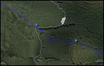
Google Maps Link (Wild Coast to Sani Lodge)
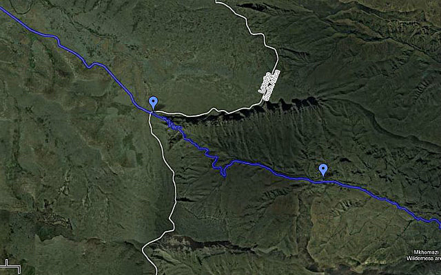
Google Maps Link (Sani Pass Tour)


Comments