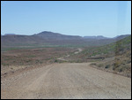
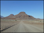
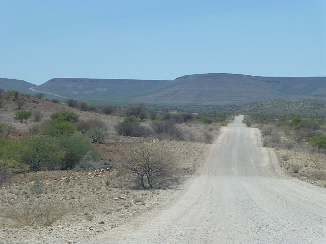
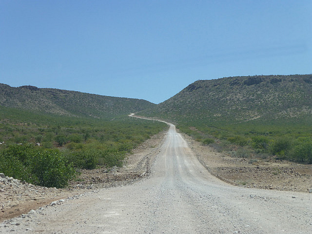
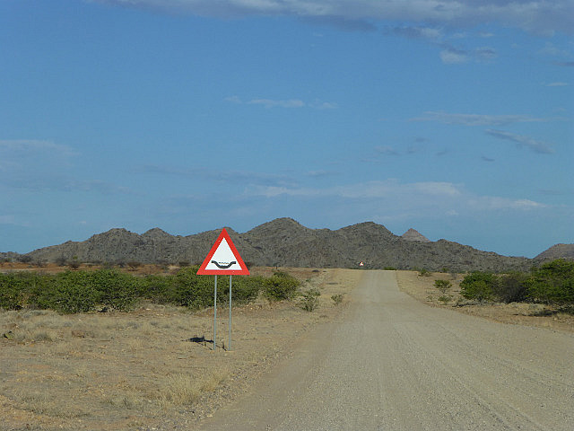
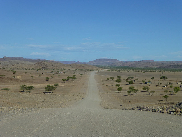
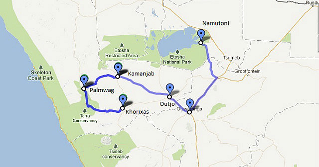
After enjoying the delights of Etosha for two days, we exited the park from its eastern boundary. It was out intention to circle back south and head west again. When we reached the town of Otavi and made a turn to take what was marked C39 on the map, we were in for a huge 'surprise'. It was a dirt road. Before we went too far, we quickly pulled out the map again and reviewed the legend. The thick yellow lines on the map, which we had assumed was just a minor road but tarred, were in fact marked "Main-Gravel Road". Only the bold red lines, of which there was a very limited network in the entire country, was paved. This was not good news. Most of the area we intended to cover in the next few days were accessible only by unpaved roads or worse - district roads that were depicted in even thinner grey lines which we had assume was unpaved as well. Based on this discovery, we had to mentally recalibrate driving times and plan accordingly.
We had an alternative but longer tarred road to get to an intermediate point, Outjo (mainly a staging point for trips to Etosha) and Khamanjab. But beyond that, it would be slow going for several days. Having no choice but to soldier on, we decided to take our time and enjoy the scenery.
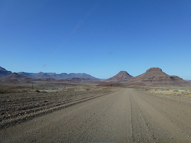
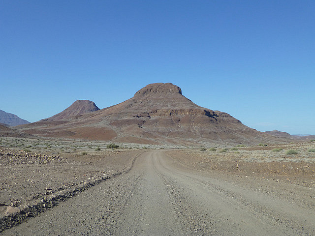
Inland from the famed Skeleton Coast of Namibia, the foggy beach gives way to desert wilderness. Sparsely populated by the Damara people, it has traditionally been known as Damaraland. It is known mostly for its geological features and though much of it is not officially protected, its wild open spaces are home to many desert adapted species of animals and plants.
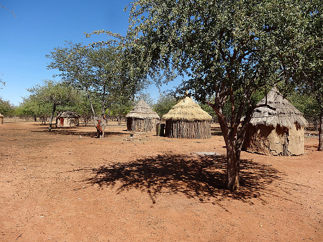
A short distance from Khamanjab is a settlement of the Himba people, the last nomadic tribe remaining in Namibia. They arrived on what is now the Angolan and Namibian border a few hundred years ago. A refusal to integrate and assimilate has kept the semi-nomadic Himba unique, living their lives as they have for millennia.
Most Himba settlements today are in northern Namibia in the Kaokoland Region and are difficult to reach. The proximity of this particular settlement to Khamanjab made it possible for us to visit them and learn about their lifestyle. Interestingly, visitors are welcome at this village. A Himba guide accompanied us around and gave us an in-depth insight into their life and ways. We learned that cattle are a central part of their culture and economy.
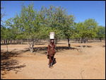
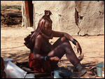
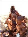
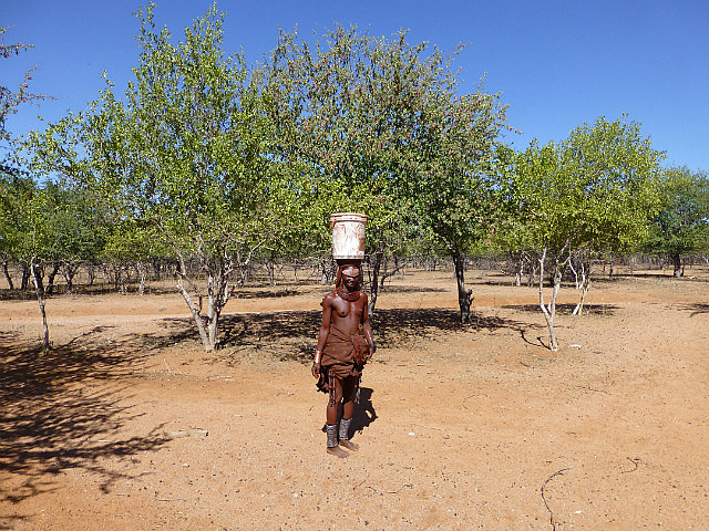
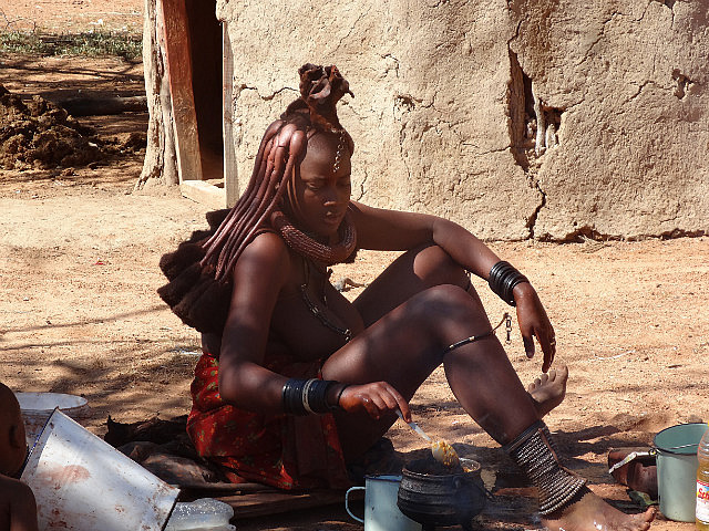
As we walked around the village, we first met a woman carrying a bucket of water over her head. We were surprised to learn that she was the village chief! We were later introduced to other young Himba women who were going about their daily business.
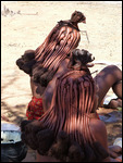
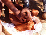
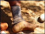
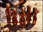
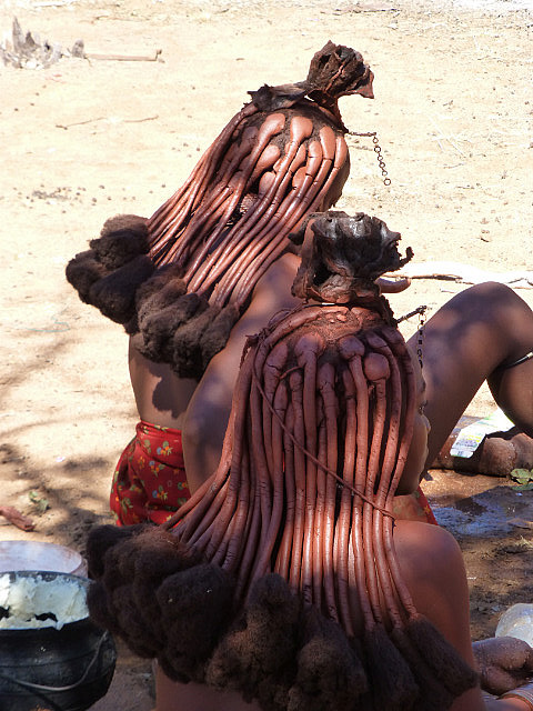
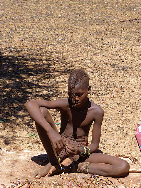
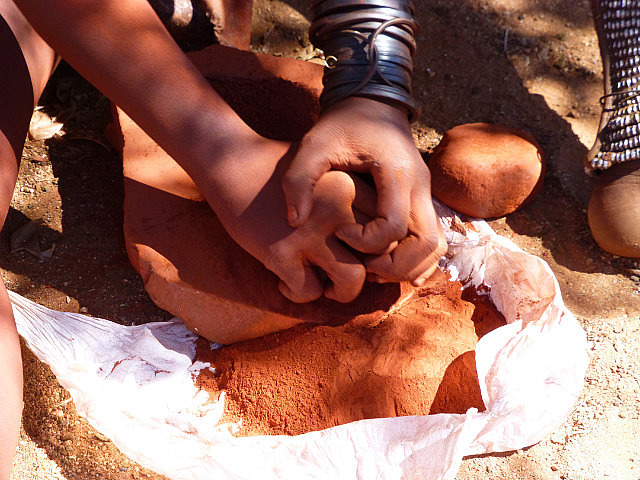
Although some of the men have adopted a more western dress, the women retain their traditional appearance. Naked except for an animal skin skirt or wrap and many adornments, they are richly colored due to the red ochre, fat and resin combination that they smear onto their skin. This protects their body from the harsh desert environment. Women wear huge cone shell necklaces and head adornment fashioned with pieces of leather. Hairstyles are unique, with girls and boys identified by their different plaits. Boys wear a single plait at the back of their head and girls wear two hanging over their face. Women have many small plaits that they coat with ochre as well.
We were introduced to a young Himba woman and with the guide acting as interpreter we were encouraged to ask questions and learn more. She was curious about us visitors and asked a few questions herself. A curios piece of trivia - Himba women do not ever wash with water! They smoke-clean themselves (like a sauna) and their clothes over a special conical apparatus made for this purpose.
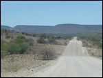
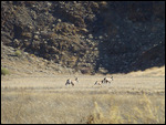
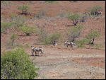
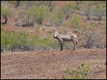
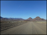
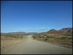
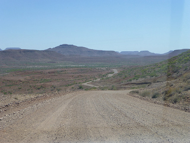
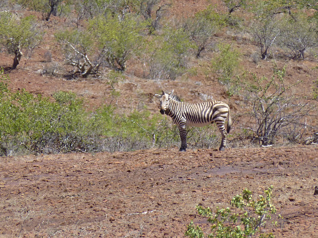
Having satisfied out curiosity about the Himba, we continued west toward the 1645m Grootberg pass. The scenery kept us absorbed even as the car had to negotiate fairly bad patches of road. Over the pass we spotted the Mountain (Hartmann's) Zebra for the first time on this trip. All the zebras we had seen in Chobe and Etosha were the Burchell's variety. The Hartmann's is stockier and does not have a shadow stripe between the black stripes.
Video: Grootberg Pass
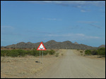
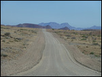
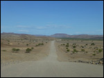
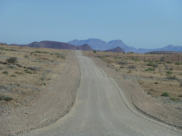
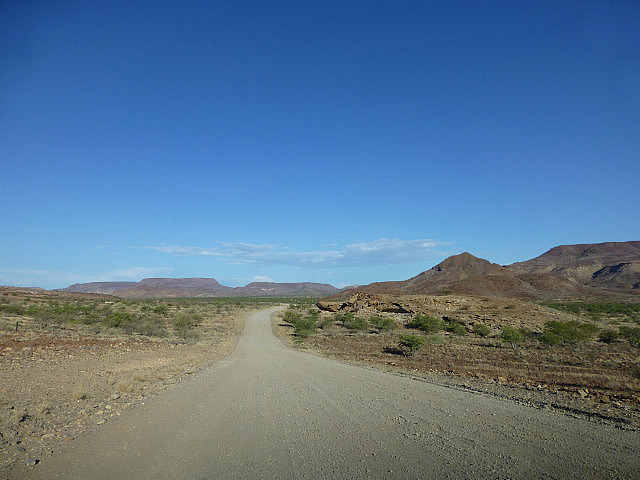
Driving for long distances on roads with uneven layers of gravel rutted with passage of heavy 4X4s and frequent dips and potholes makes driving quite interesting. The car frequently drifts where you don't intend it to go, giving you the feeling you are not completely in control. But the road is wide enough that there is no danger of going off the road. Sometimes long stretch of the road can be so badly rutted or unevenly weathered that makes for bone rattling driving. And then there is no concept of right or wrong side of the road. One drives on what appears to a suitable track made by earlier vehicle until it deteriorates to the extent that one is forced to change tracks. This preferred track can be anywhere along the breadth of the road and given the fact that you don't see any other vehicles for hours, it is normally safe to drive on any side you fancy.
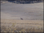
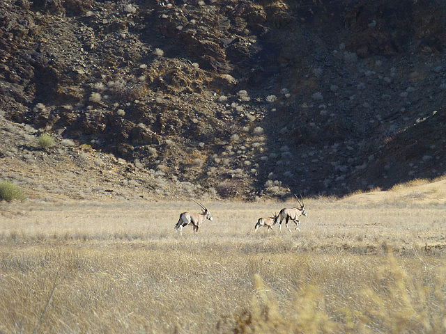
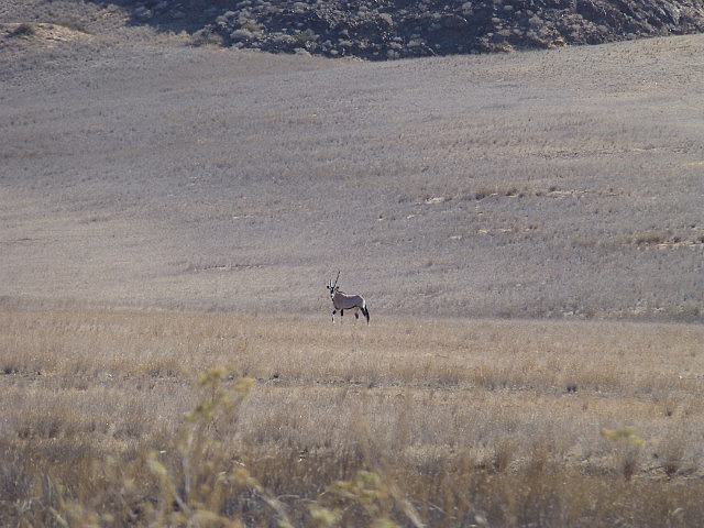
Despite all this, unfenced land and gravel roads impart a sense of freedom that has its own appeal. This coupled with random appearance made by wildlife just roaming the countryside makes driving in Namibia a unique experience. We frequently encountered springbok grazing along the road and even a family of Oryx galloping away towards a distant hill!
Video: Oryxes running
Our final destination for the day was a campsite at Twyfelfontein, close to a World Heritage Site that has one of the largest concentration of petroglyphs in Africa. We were a little short on cash and intended to get some from an ATM enroute. Many lodges and campsite in Namibia do not accept credit cards ant. According to the map, the only town between where we were and Twyfelfontein was Palmwag. The town's name was printed in fairly large font and the it even showed a gas station icon alongside giving us hope that we would find an ATM there. But as we approached Palmwag, we found that the town was essentially made up of a gas station and a luxury lodge. That was it! We went into the lodge to check if they had an exchange bureau, but they did not. Having used up part of the remaining cash for gas, we were left with insufficient funds for a nights stay anywhere along the way. The closest town with ATM potential was Khorixas that was 165 kms away and over 80 km beyond Twylfelfontein. Phone calls to the campsite eliminated any chance they would accept credit cards and we were left with no option but to continue to Khoraxis, at least three hours away. We pulled into Khoraxis just before sunset and located the only working ATM in town.
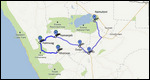
Google Maps Link


Comments