Debates about the world's great waterfalls tend to get misty and unwieldy just like the falls themselves. Which is the biggest? Widest? Highest? Do we only consider a single uninterrupted fall or can we be flexible? What about jutting pieces of rock that split falls into many individuals?
We have no intention of resolving the above debate in this post. The magnificence of Victoria Falls/Mosi-oa-Tunya (Smoke That Thunders) need not depend on its numerical statistics. It is similar in many ways to other great falls of the world (Iguazu Falls and Niagara Falls are frequently compared with it) while remaining unique in others.
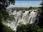
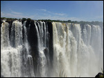
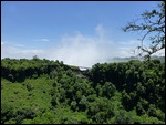
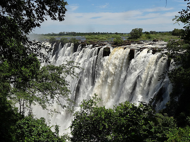
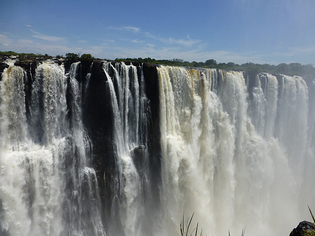
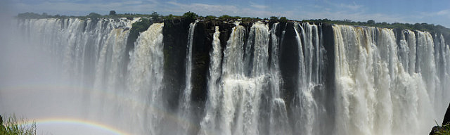
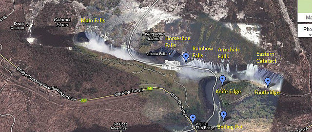
The mighty Zambezi river is the 4th longest (no debates here!) river in Africa (after The Nile, Niger and Congo rivers). It flows through several Southern African countries in a roughly easterly direction before emptying into the Indian Ocean in Mozambique. The flat expanse of water just meters upstream of the falls give no indication of its immediate fate. It falls into a deep (first) gorge before continuing through a series of gorges. Due to this peculiar formation, it is not possible to view the entire width of the falls from a distant viewpoint. One has to get up close and watch the falls from across the first gorge's 150m chasm.
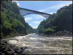
While much of the width of the falls lies in Zambia (the eastern portion), one can see more of the falls from the Zimbabwean side. Endless debates rage on about which is the better viewing option. Happily, the Victoria Falls bridge that separate the two sides is a short walk linking the two countries and visitors can get the best of both worlds. The Zambian side has seen a recent rise in tourism due to the recent troubles in Zimbabwe.
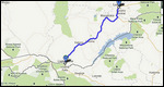
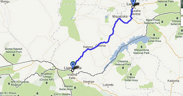
The town of Livingstone is just 11km from the Zambian falls. It can be reached by public bus from Lusaka in 6 hours. There are several companies that vie for your business and there is a daily business class service for those who want a little extra comfort. While it was not built to be a tourist town (unlike the town of Victoria Falls on the Zimbabwean side), it does provide a comfortable base for those choosing the Zambian option. Sadly, those wishing to walk or bicycle the 11km distance from the town to the falls are discouraged from doing so due to risk of robbery.
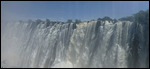
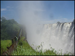
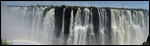
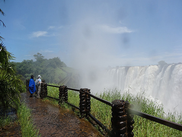
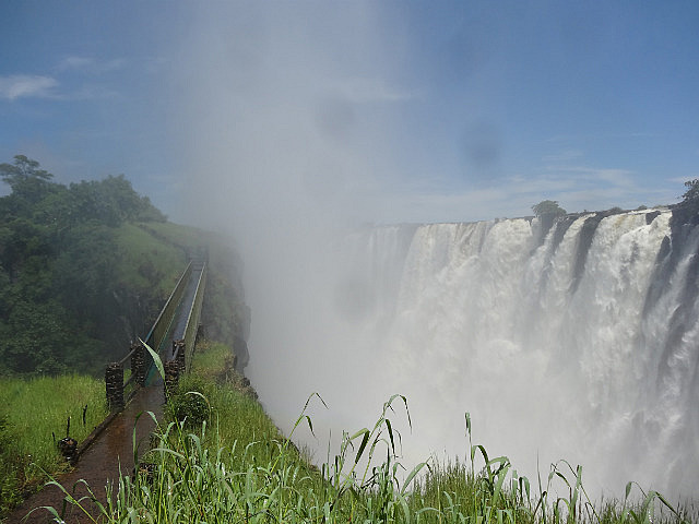
The experience of viewing the falls depends on the season. During the flood season, the falls are at their greatest flow and the large water curtain is almost uninterrupted by gaps. It would be impossible to view the bottom of the falls during this season due to the massive mist cloud that rises up from the gorge (and can be seen as a cloud several kilometers away). What looks like mist turns out to be a heavy uppour - rain that flows upwards. Underestimate this at your peril. Only one of us had a rain poncho and the other had to rent a raincoat (conveniently available just at the start of the trail). It is an experience to be thoroughly drenched from below and above on a cloudless sunny day. During the dry season, the flow is much reduced and several "gaps" can be seen in the curtain. The uppour effect will be minimal and one can see the bottom of the falls. Our visit was clearly in the flood season.
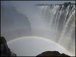
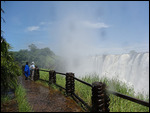
There are three walking trails on the Zambian side. The one closest to the falls - the Knife edge track - skirts the cliff on the opposite side. From this track one can view the eastern side of the falls. The individual sections are named Eastern Cataract, Armchair Falls, Rainbow Falls and Horeseshoe Falls. Livingstone island separates these falls from those on the Zimbabwean side. Due to the thick mist cloud, we could not see beyond the Zambian side. We also had to hurriedly put away our cameras to prevent water damage. The track ends at Knife Edge, the furthest point on the Zambia side overlooking the first gorge. In the middle of the track is a footbridge that offers a unique experience. Two full concentric rainbow circles! These extend below the bridge and come up the other side! One can enjoy this while going through the hair-raising experience of walking on a narrow bridge with the roar of the mighty falls pouring into your ears from close quarters.
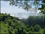
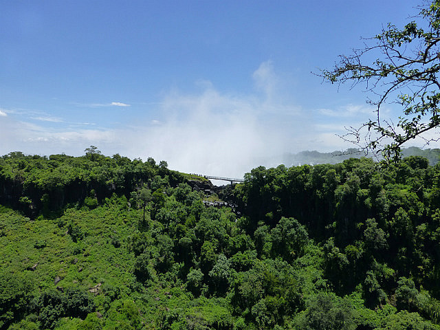
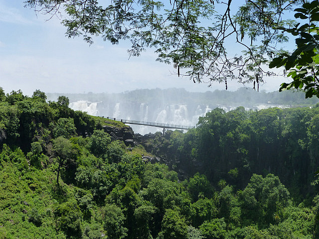
After getting our fill of the falls from this track and getting thoroughly drenched, we retraced back to the trailhead and explored the other two tracks. The so-called Photography track is the most distant from the falls but allows for more comfortable photography. One can only see the tops of the falls from this viewpoint.
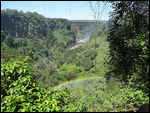
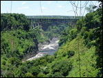
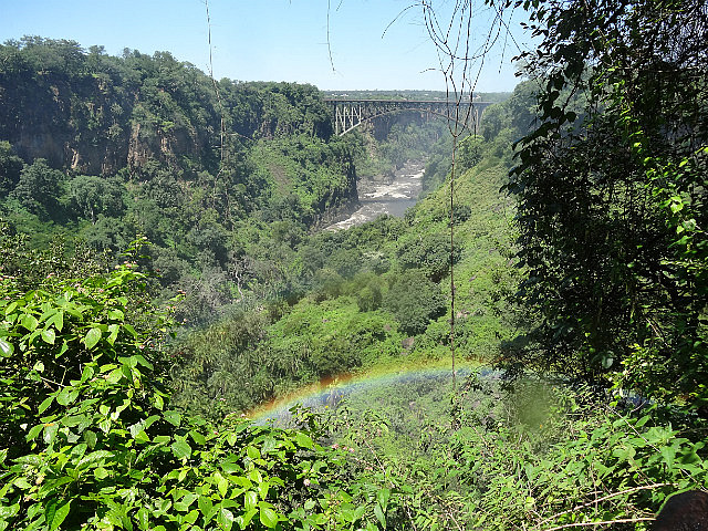
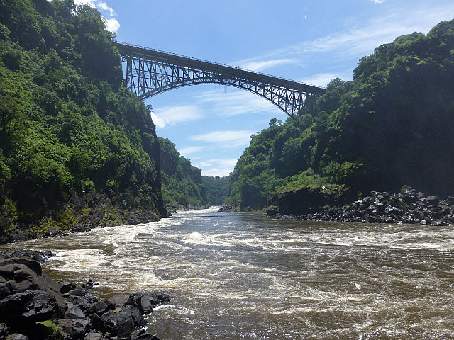
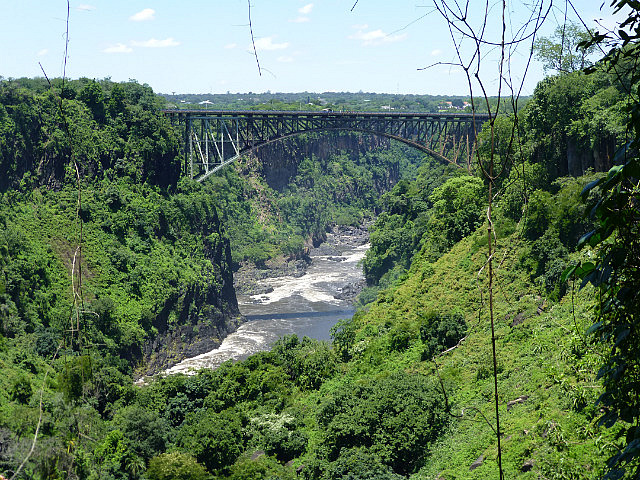
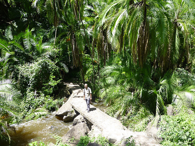
The third, Boiling Pot Track, turned out to be a little surprise. This descends about 300m through a thick jungle populated by ill-mannered apes and down to the level of the second gorge. This is the point where all the water that had fallen from their great heights and exited through a narrow exit in the first gorge, collects in a raging vortex. This is called the Boiling potand is beneath the Victoria Falls bridge that frames it nicely above. After this point, the water loses its anger at being thrown around and becomes a river again and gently zig-zags its way through several more gorges and then on its way to its Indian Ocean destination.
Google Maps Link (Lusaka to Livingstone)
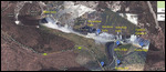
Google Maps Link (Victoria Falls)


Comments