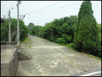
Three approximately parallel and equidistant lines separate the two Koreas. The width of the area separated by the top and bottom lines is 4km. with each half 2km long. The middle line that temporarily (60 years and counting) forms the international border is termed the MDL. The 4km wide no man's land stretches 240km coast to coast and is termed the DMZ, the Demilitarized Zone.
Civilians (Koreans and Foreigners) are allowed to visit the DMZ with the help of a handful of tour companies. Only the tour run by the USO (United Services Organization) gets access to the JSA (Joint Security Area) that is designated for diplomatic communications between the two Koreas. The two nations are still technically at war and relations are particularly frosty. But the tour is not without its lighter moments despite the atmosphere of tension. The tours need to be booked well in advance and tourists are told to dress "respectfully". No sandals, shorts, jeans or T-shirts with provocative messages.
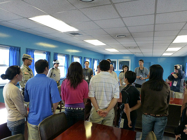
An hour's ride on the USO bus takes the visitor into the DMZ where civilian control stops and military control takes over. Once inside, one is transferred to a different bus that is escorted by US soldiers who narrate the tour in a familiar American accent. We had to sign waivers to absolve our escorts of any responsibility should there be any untoward incident that caused us harm through enemy action.
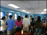
A short slide show briefs the visitors on the history of the war and subsequent incidents (the Ax Murder Incident of 1976 and the more recent killing of an unfortunate South Korean civilian who had inadvertently strayed into the northern part of the DMZ on a hiking trip). There were several reminders to the visitors to not gesture at the North Korean soldiers stationed inside the JSA as this could be mistaken for a provocative act which could potentially escalate tension. At the very least, such gestures could be used by the North for propaganda.
The US escorts were very particular about instructing the tourists on where and where not to take photographs and in what directions. They shared their own nicknames of North Korean installations which brought about a chuckle from the group.
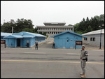
The few hours in the DMZ included visits to the JSA (MAC Hall, Observation post, the Bridge of No Return, The Ax Murder Incident Memorial, The 3rd Tunnel, The Dora Observatory and the Dorasan Railway Station).
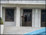
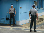
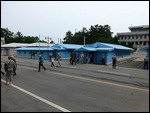
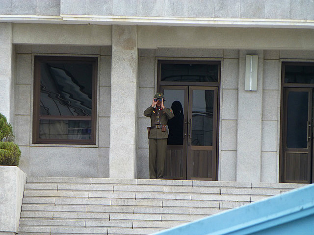
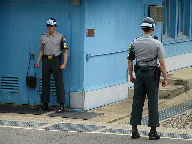
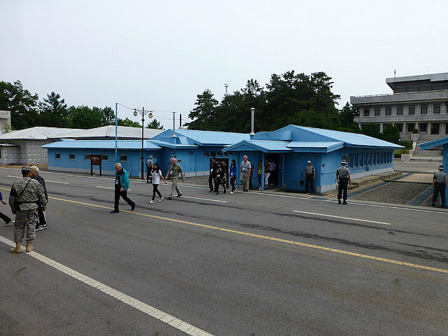
The MAC Hall is the highlight of the trip. This is the area on the MDL (Military Demarcation Line) where KPA (Korean People's Army - aka North) and the ROK (Republic of Korea - South) soldiers stand face to face with just a few feet separating them. We were told that the South Korean soldiers take up their standing positions only when tourists visit. Two of the soldiers stand at the edge of walls only exposing half their bodies to the North so as to not form a target. Just a few feet north is the North Korean side of the DML where a North Korean soldier was standing at ease observing the tourists with binoculars. Our US escorts informed us that each one of us is being observed carefully by several cameras and personnel from the North. Again, we were reminded not to gesture or make faces at them. But we were encouraged to smile for their hidden cameras.
Once indoor inside the MAC Hall, we could only see a pair of South Korean soldiers standing in sharp combat pose with fists clenched and eyes hidden behind sun glasses. We were told to not get too close to them and not use our camera flashes. We were free to take photographs facing the North and to walk to the right of the negotiating table which technically takes us a few feet into North Korea. Someone unintentionally set off a flash that resulted in the South Korean soldier briefly shake his head in disapproval before resuming his statue stance. We were told that the soldiers were there for our protection. Our US escorts assured us that these soldiers were experts in Taekwondo and other martial arts and the very best at what they do. They looked like the most serious people on earth. We, who were gaily getting ourselves photographed standing next to them made a good contrast.
We were told that tourists from the North visit from the other side as well.
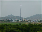
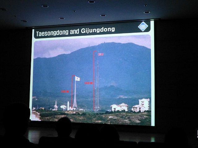
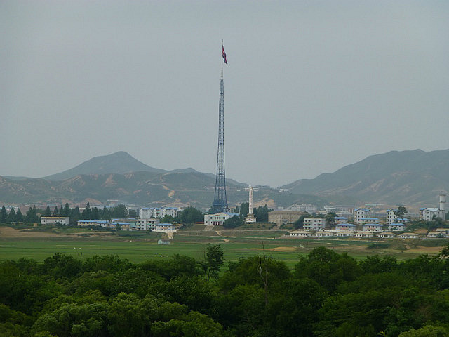
At the nearby observation post we could see the adjacent North Korean areas including their high flag perched atop the third highest flagpole in the world (we saw the 2nd highest at the Gulf of Aqaba in Jordan during our 2010 visit there and hopefully see the highest in Turkmenistan during this trip) that was raised to its current height when a tall South Korean flag was posted on the southern side of the border. Each side of the DMZ has a village within which these flags fly. The residents of the South Korean village only include those who lived in the vicinity before the war. They practice agriculture and are provided security by the army. Our escorts were very skeptical about the village on the north side. They claimed that nobody really lived there and the houses were only made up by the North for propaganda. Their nickname for that village was Propaganda Village as it used to have loudspeakers spewing Communist messages exhorting the villagers on the south side to come and live in the North.
The bus briefly stopped at the Ax Murder incident memorial for the 1976 confrontation around the cutting of a poplar tree that was obstructing clear view between two observation posts. Both sides claim that the other was at fault. We also saw the Bridge of No Return where POWs from both sides were given the opportunity to pick their choice of residence but only once. Hence the name - Bridge of No Return. We also saw hotline phones installed to aid defectors from the north to get help from the south.
The 3rd Tunnel area is outside the JSA where a tunnel was discovered by the South after a defector reported it to them. The South claims that the tunnel was dug by the North for a planned invasion. The North claims that it was for coal mining. The South has since blockaded the tunnel within but dug their own sloping tunnel path in 2004 to allow visitors down to the 3rd blockade (within 170 m of the DML) so they can see for themselves. There were yellow markings on the walls which the South claims was painted by the North for detonation and black coal powder which the South claims was planted by the North for their false coal mining claims. The underground walk required helmets and bent heads and is not suitable for the elderly or those with health problems.
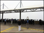
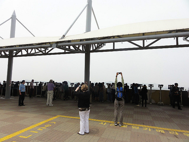
The haze that hung over the area prevented us from seeing too much of the landmarks on the North side that can normally be seen from the Dora observatory. The civilian tour guide stressed that there were 25000 statues of Kim Il-sung in North Korea. The poor visibility prevented us from being able to see the one example that could be seen from here. There was a yellow demarcation line drawn on the viewing platform and people were told to not take photos beyond that line. It was a strange sight to see everyone stretching their hands high on tiptoe to capture the foggy landscape of North Korea.
The one redeeming aspect of this whole sorry situation is the natural formation of an ecological reserve along the DMZ. Due to the absence of human civilization on the 4km. wide corridor, several animal and bird species have returned from near extinction and are thriving in the area.
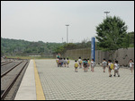
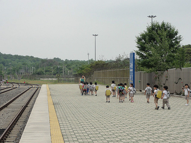
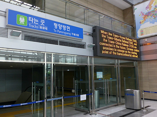
The final stop at the Dorasan Railway Station leaves the visitor in an upbeat mood. This marks the last station on the south side that is still in civilian control. Technically, the last station on the south side is inside the DMZ. Someday, in the future, trains will operate across the border. Signs at the station platform (one had to buy a ticket to get to the empty platform) indicated 205km. to Pyongyang. A group of small kids were walking on the platform led by their teacher. They seemed too young to be able to understand the meaning of this station. But, hopefully, some of them would get to travel on a train to the north someday in future. For today, they could run about and frolic on the platform oblivious to the presence of strange foreigners who themselves were having a good time walking on the tracks and getting themselves photographed in front of the signs.


Comments